Understanding the Role of Technology in Disaster Management
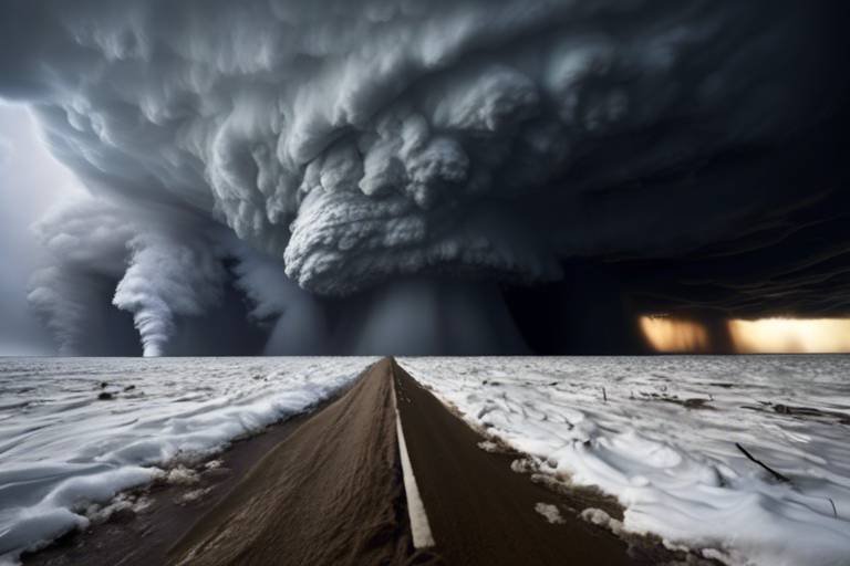
In today's fast-paced world, the intersection of technology and disaster management is more crucial than ever. Imagine a scenario where a natural disaster strikes—how prepared are we to respond? Technology enhances our ability to prepare, respond, and recover from such emergencies, acting as a lifeline that can ultimately save lives and resources. From advanced communication systems to real-time data analytics, technology has transformed the way we manage disasters, making our efforts not only more efficient but also more effective.
Consider the traditional methods of disaster management that relied heavily on manual processes and delayed communication. Now, with the advent of modern technology, we can harness a plethora of tools that streamline operations. For instance, think about how smartphones have revolutionized communication. They allow emergency services to send alerts and updates in real-time, keeping communities informed and safe. This shift not only enhances our preparedness but also fosters a culture of resilience, where individuals and communities are better equipped to face crises.
Moreover, the integration of technology in disaster management is not just about immediate response; it also plays a pivotal role in recovery efforts. After a disaster, the ability to analyze data quickly and accurately can make a significant difference in how resources are allocated. For example, using Geographic Information Systems (GIS), responders can map affected areas, analyze damage, and prioritize assistance based on need. This level of detail ensures that help reaches those who need it the most, making recovery less chaotic and more coordinated.
As we explore the various facets of technology in disaster management, it's essential to recognize that this is not just a one-size-fits-all solution. Different types of disasters require different technological approaches. For instance, the technology used in urban areas may differ significantly from that used in rural regions. This adaptability is crucial for effective disaster management, as it allows us to tailor our strategies to the unique challenges posed by each situation.
Ultimately, understanding the role of technology in disaster management is about recognizing its potential to enhance our capabilities. By embracing innovation and fostering collaboration among various stakeholders—governments, NGOs, and the private sector—we can create a robust framework that not only mitigates the impact of disasters but also empowers communities to thrive in the face of adversity.
- How does technology improve disaster preparedness?
Technology enhances disaster preparedness by enabling better planning, training simulations, and efficient resource allocation, ensuring communities are ready for emergencies. - What role do drones play in disaster management?
Drones provide aerial views of disaster-affected areas, allowing for rapid damage assessment and resource planning, which is crucial for effective response efforts. - How do emergency alert systems work?
Emergency alert systems utilize various technologies to send timely warnings to communities, helping to inform residents about threats and necessary evacuation procedures. - Can social media be trusted during disasters?
While social media can be a valuable tool for real-time updates, it's essential to verify information from credible sources to avoid misinformation during crises.

The Importance of Technology in Disaster Preparedness
When it comes to disaster preparedness, technology is not just a helpful tool—it's a game changer. Imagine trying to navigate a storm without a map or a compass; that's what communities face without the right technological support. With advancements in technology, we can enhance our planning, training, and resource allocation, ensuring that when disaster strikes, we are not caught off guard.
One of the most significant benefits of technology in disaster preparedness is its ability to facilitate data-driven decision-making. By leveraging data analytics, communities can identify potential risks and vulnerabilities within their areas. For instance, using historical data on past disasters, local governments can pinpoint which regions are most susceptible to flooding, earthquakes, or wildfires. This proactive approach allows for strategic resource allocation, ensuring that emergency services are concentrated in the most at-risk areas.
Moreover, technology enables effective training and simulation exercises. Virtual reality (VR) and augmented reality (AR) can create realistic disaster scenarios for first responders and community members. These immersive training experiences prepare individuals for real-life emergencies, enhancing their skills and confidence. Just like a pilot practices in a flight simulator before taking to the skies, emergency responders can hone their skills in a controlled environment, making them more effective when it truly counts.
Additionally, technology enhances communication among various stakeholders involved in disaster management. Whether it's government agencies, non-profit organizations, or local volunteers, clear communication is vital for effective coordination. With tools like mobile apps and web platforms, information can be shared quickly and efficiently. For instance, during a hurricane, updates about evacuation routes, shelter locations, and safety tips can be disseminated through SMS alerts or social media, reaching thousands of residents in mere minutes.
Furthermore, technology allows for the integration of various systems that work together to improve disaster preparedness. Geographic Information Systems (GIS), for example, play a crucial role in mapping out disaster-prone areas, analyzing risk factors, and planning evacuation routes. By visualizing data on maps, emergency planners can create more effective strategies to mitigate risks. This comprehensive approach ensures that communities are not only prepared but also resilient in the face of adversity.
In summary, the importance of technology in disaster preparedness cannot be overstated. It is the backbone that supports planning, training, and communication efforts, ensuring that communities are well-equipped to handle emergencies. Just as a well-prepared athlete trains rigorously for a competition, communities that embrace technology are better prepared to face the unexpected challenges that disasters bring.
- How does technology improve disaster preparedness?
Technology enhances disaster preparedness by facilitating data-driven decision-making, improving training through simulations, and ensuring effective communication among stakeholders. - What role do GIS systems play in disaster management?
GIS systems help in mapping disaster-prone areas, analyzing risk factors, and planning evacuation routes, which are essential for effective disaster response. - Can technology help in community training for disasters?
Yes, technologies like virtual reality and augmented reality offer realistic training simulations, preparing community members and responders for real-life emergencies.

Real-Time Data Collection and Analysis
In the chaotic moments of a disaster, every second counts. This is where real-time data collection comes into play, acting like a lifeline for emergency responders and affected communities. Imagine trying to find your way through a dense fog without a map—this is how disaster management operates without timely data. With technology, we can cut through that fog and gain a clear view of the situation at hand. Real-time data allows for timely analysis and decision-making, which is crucial for enhancing situational awareness and improving response efforts on the ground.
One of the most significant advantages of real-time data collection is its ability to provide immediate insights into the evolving nature of a disaster. For instance, when a hurricane approaches, meteorological data can be collected through various means—satellites, weather stations, and even mobile apps. This data can then be analyzed quickly to inform the public about the storm's trajectory, potential impact, and necessary safety measures. The faster we can interpret this information, the better prepared we can be.
Moreover, the integration of advanced technologies like Internet of Things (IoT) devices has revolutionized how we collect and analyze data. Sensors can be deployed in disaster-prone areas to monitor environmental conditions, such as changes in temperature or humidity that might indicate a wildfire's potential. These sensors can send alerts in real-time, allowing for swift action before a situation escalates. For example, a network of sensors might detect rising water levels in a river, triggering early warnings for communities downstream.
To illustrate the impact of real-time data collection, consider the following table that outlines various technologies used in disaster management:
| Technology | Purpose | Benefits |
|---|---|---|
| Satellites | Monitor weather patterns and natural disasters | Provides comprehensive views of affected areas |
| Drones | Conduct aerial surveys | Offers quick assessments of damage |
| IoT Sensors | Monitor environmental conditions | Enables early warnings and proactive measures |
| Mobile Apps | Disseminate information to the public | Keeps communities informed in real-time |
In addition to these technologies, the role of data analytics cannot be overstated. By analyzing historical data alongside real-time information, responders can identify patterns and predict potential outcomes. This predictive capability is akin to having a crystal ball that helps us foresee the future, allowing for better planning and resource allocation. For example, if past data shows that certain neighborhoods are more prone to flooding, emergency services can pre-position resources in those areas ahead of time.
Ultimately, real-time data collection and analysis transform the way we approach disaster management. They empower communities to be proactive rather than reactive, significantly reducing the risks associated with emergencies. By harnessing the power of technology, we can ensure that when disaster strikes, we are not left in the dark but are instead equipped with the knowledge and tools necessary to respond effectively.
- How does real-time data collection improve disaster response?
Real-time data collection provides immediate insights into the situation, allowing for quicker decision-making and more effective resource allocation. - What technologies are commonly used for data collection during disasters?
Common technologies include satellites, drones, IoT sensors, and mobile applications that help disseminate information quickly. - Can real-time data help in predicting disasters?
Yes, by analyzing historical data alongside real-time information, patterns can be identified, which aids in predicting potential disaster scenarios.

Remote Sensing Technologies
are revolutionizing the way we understand and respond to disasters. Imagine being able to see the world from above, capturing real-time images and data that can inform critical decisions during emergencies. This is precisely what remote sensing offers through the use of satellites and drones. These technologies provide a bird's-eye view of disaster-prone areas, enabling authorities to identify risks and monitor environmental changes that could lead to crises.
The beauty of remote sensing lies in its ability to gather data without being physically present in the area of interest. For example, satellites orbiting the Earth can capture high-resolution images of landscapes affected by natural disasters like hurricanes, floods, or wildfires. This information is invaluable for emergency responders, as it allows them to assess damage, plan effective responses, and allocate resources where they are most needed.
Drones, on the other hand, have emerged as a game-changer in disaster management. Equipped with cameras and sensors, these unmanned aerial vehicles can swiftly survey areas that may be too dangerous or inaccessible for human teams. They can fly over disaster-stricken regions and capture detailed images, providing insights that traditional ground surveys may miss. For instance, after an earthquake, drones can quickly map out the extent of the damage, helping responders prioritize areas that require immediate assistance.
Furthermore, the integration of remote sensing technologies with Geographic Information Systems (GIS) enhances their effectiveness. By combining satellite and drone data with GIS, emergency managers can create detailed maps that visualize risk factors, population density, and infrastructure vulnerabilities. This holistic view enables them to devise better evacuation routes and response strategies, ultimately saving lives and resources.
In summary, remote sensing technologies are indispensable tools in disaster management. They not only improve our ability to monitor and assess risks but also enhance our preparedness and response efforts. With these technologies at our disposal, we can create safer communities and ensure that help reaches those in need more efficiently.
- What are remote sensing technologies? Remote sensing technologies refer to the methods used to collect data about an area from a distance, typically using satellites or drones.
- How do satellites help in disaster management? Satellites provide high-resolution images of disaster-affected areas, helping responders assess damage and coordinate relief efforts.
- What advantages do drones offer over traditional assessment methods? Drones can quickly survey dangerous or inaccessible areas, providing real-time data and imagery that traditional methods may not capture promptly.
- How can remote sensing be integrated with GIS? Remote sensing data can be combined with GIS to create detailed maps that visualize risks, helping emergency managers plan more effectively.

Satellite Imagery in Disaster Monitoring
When disaster strikes, time is of the essence. Satellite imagery has become an indispensable tool in the realm of disaster monitoring, providing responders with critical information that can make a significant difference in managing emergencies. Imagine being able to see the entire landscape of a disaster-affected area from space, identifying not only the extent of the damage but also the most affected communities. This bird’s-eye view allows for a more effective and coordinated response, ultimately saving lives and resources.
One of the most compelling advantages of satellite imagery is its ability to deliver real-time data. This means that as a disaster unfolds—be it a hurricane, earthquake, or wildfire—responders can access updated images that reflect the current situation. For instance, after a hurricane makes landfall, satellite images can show flooding patterns, damage to infrastructure, and even changes in vegetation. Such insights are invaluable for emergency management teams who need to prioritize their efforts and allocate resources efficiently.
Moreover, satellite imagery is not just reactive; it can also be proactive. By analyzing historical data and current satellite images, experts can identify trends and patterns that may indicate potential disaster risks. For example, if satellite data reveals that a particular region is experiencing unusual land subsidence, authorities can investigate further to mitigate risks before a disaster occurs. This kind of foresight is crucial in disaster preparedness and can lead to better planning and resource allocation.
In addition to immediate damage assessment, satellite imagery plays a pivotal role in long-term recovery efforts. After the initial response phase, recovery teams can use satellite images to monitor rebuilding progress, track changes in land use, and ensure that affected areas are restored to their former state—or even improved. This ongoing monitoring helps to ensure that recovery efforts are effective and that communities can return to normalcy as quickly as possible.
To illustrate the impact of satellite imagery in disaster monitoring, consider the following table that highlights different applications:
| Application | Description |
|---|---|
| Damage Assessment | Evaluating the extent of destruction caused by disasters, allowing for efficient resource allocation. |
| Risk Analysis | Identifying vulnerable areas and potential hazards to improve preparedness. |
| Recovery Monitoring | Tracking the progress of rebuilding efforts and assessing changes over time. |
In summary, satellite imagery is a powerful asset in the toolkit of disaster management. It not only enhances our understanding of the immediate impacts of disasters but also aids in planning and recovery efforts. As technology continues to evolve, the integration of satellite imagery into disaster response strategies will undoubtedly become even more sophisticated, paving the way for smarter, more effective disaster management practices.
- How often is satellite imagery updated during a disaster? Satellite imagery can be updated as frequently as every few minutes, depending on the satellite's capabilities and the urgency of the situation.
- Can satellite imagery be used for all types of disasters? Yes, satellite imagery is versatile and can be used for various types of disasters, including floods, wildfires, hurricanes, and earthquakes.
- What technology is used to analyze satellite imagery? Advanced software and algorithms, including machine learning and artificial intelligence, are often used to analyze satellite images for better insights.

Drones for Damage Assessment
Drones, or unmanned aerial vehicles (UAVs), have revolutionized the way we assess damage after disasters strike. Imagine having a bird's-eye view of a disaster zone, capturing real-time images and data that can significantly enhance our understanding of the situation on the ground. These flying marvels are not just toys; they are powerful tools that provide crucial insights that traditional methods often miss. For instance, while it might take days or even weeks for a team to conduct a thorough ground assessment, drones can cover vast areas in a matter of hours.
One of the most compelling advantages of using drones for damage assessment is their ability to access hard-to-reach areas. After a natural disaster like an earthquake or a flood, certain regions may become inaccessible due to debris, damaged infrastructure, or ongoing hazards. Drones can effortlessly navigate these obstacles, capturing high-resolution images and videos that allow responders to evaluate the extent of the damage without putting themselves at risk.
Furthermore, the data collected by drones can be analyzed using sophisticated software to create detailed maps and 3D models of the affected areas. This information is invaluable for emergency responders and recovery teams. It helps them to:
- Identify the most severely impacted locations
- Prioritize resource allocation for relief efforts
- Plan effective evacuation routes for residents still in danger
- Monitor the recovery process over time to ensure that help is reaching those in need
In addition to their practical applications, drones can also assist in search and rescue operations. Equipped with thermal imaging cameras, drones can locate survivors trapped under debris, even in low visibility conditions. This capability can mean the difference between life and death, as it allows rescue teams to act swiftly and efficiently.
As we continue to innovate and improve drone technology, the potential for their use in disaster management only grows. With advancements in battery life, payload capacity, and data processing, we can expect drones to play an even more significant role in future disaster assessments. They are not just a trend; they are becoming an essential component of our emergency response toolkit, making the world a safer place one flight at a time.
- How do drones collect data for damage assessment?
Drones are equipped with high-resolution cameras and sensors that capture images and data during their flights. This information is transmitted back to operators in real-time, allowing for immediate analysis. - What types of disasters can drones be used for?
Drones can be utilized in various disaster scenarios, including earthquakes, floods, hurricanes, and wildfires, providing critical information quickly. - Are drones safe to use in disaster zones?
Yes, drones are designed to operate safely in challenging environments. They can be deployed in areas that may be dangerous for human responders, minimizing risk while maximizing data collection. - How do drones help in search and rescue operations?
Drones equipped with thermal imaging can detect body heat, enabling search teams to locate survivors in difficult-to-access areas, even at night or in poor visibility.

Geographic Information Systems (GIS)
Geographic Information Systems (GIS) are revolutionizing the way we approach disaster management. Imagine having the ability to visualize and analyze complex data related to geographical locations—this is precisely what GIS offers. By integrating various data sources, GIS creates a comprehensive view of disaster-prone areas, highlighting vulnerabilities and enabling informed decision-making. It’s like having a crystal ball that not only shows where disasters might strike but also helps us prepare for them.
One of the most significant advantages of GIS in disaster management is its capability to map risk factors. For instance, GIS can analyze historical data on floods, earthquakes, and wildfires to identify patterns and predict future occurrences. This predictive power allows communities to allocate resources more efficiently, ensuring that emergency services are ready to respond when disaster strikes. Furthermore, GIS helps in planning evacuation routes by analyzing traffic patterns and identifying safe zones, which is crucial for saving lives during emergencies.
Additionally, GIS plays an essential role in post-disaster recovery. After a disaster, responders can use GIS to assess damage quickly and accurately. By overlaying pre-disaster maps with post-disaster imagery, responders can determine which areas need immediate attention and allocate resources accordingly. This not only speeds up the recovery process but also ensures that aid reaches those who need it the most.
To illustrate the impact of GIS, consider the following table that outlines its applications in various stages of disaster management:
| Stage of Disaster Management | GIS Applications |
|---|---|
| Preparedness | Risk mapping, resource allocation, evacuation planning |
| Response | Damage assessment, resource distribution, situational awareness |
| Recovery | Infrastructure planning, rebuilding efforts, monitoring progress |
In summary, GIS is not just a tool; it’s a game-changer in disaster management. Its ability to integrate and analyze geographical data empowers communities to prepare for, respond to, and recover from disasters more effectively. As technology continues to advance, the role of GIS will undoubtedly expand, offering even more sophisticated solutions to the challenges posed by natural disasters.
- What is GIS? Geographic Information Systems (GIS) is a technology that allows for the visualization, analysis, and interpretation of spatial data.
- How does GIS help in disaster management? GIS helps by mapping risk factors, planning evacuation routes, assessing damage, and facilitating recovery efforts.
- Can GIS be used in real-time during disasters? Yes, GIS can provide real-time data analysis and mapping, which is crucial for effective disaster response.
- What are some examples of GIS applications? Examples include flood risk mapping, wildfire monitoring, and post-disaster damage assessment.

Communication Technologies in Crisis Situations
In the chaotic midst of a disaster, when every second counts, effective communication technologies emerge as the unsung heroes. Imagine a world where vital information flows seamlessly between emergency responders and the public, ensuring that everyone is on the same page. This is precisely what these technologies achieve during crises. They not only facilitate coordination among responders but also allow for the rapid dissemination of critical information to those in peril, ultimately saving lives and reducing panic.
One of the most significant advancements in this area is the development of Emergency Alert Systems (EAS). These systems harness the power of technology to send out timely warnings about impending threats, such as severe weather events or natural disasters. Picture receiving a text alert on your phone just moments before a tornado strikes. This timely notification can make all the difference, providing residents with the information they need to take immediate action, such as seeking shelter or evacuating the area.
Furthermore, social media platforms have revolutionized the way we communicate during emergencies. In a world where millions are connected at the touch of a button, these platforms serve as vital tools for sharing real-time updates. For instance, during a flood, local authorities can post live updates on Twitter or Facebook, keeping the community informed about evacuation routes, shelter locations, and safety tips. Not only do these platforms allow for quick dissemination of information, but they also enable responders to gather crucial insights from the public, such as reports of trapped individuals or areas requiring immediate attention.
Moreover, the integration of mobile applications designed for emergency management has further enhanced communication capabilities. These apps can provide users with personalized alerts based on their location, ensuring that they receive information relevant to their specific situation. Imagine an app that alerts you about a wildfire approaching your neighborhood, offering evacuation routes and safety protocols right at your fingertips. This kind of technology empowers individuals to take proactive steps in safeguarding themselves and their families.
To illustrate the impact of these communication technologies, consider the following table that outlines the various tools and their specific functions during a crisis:
| Technology | Function |
|---|---|
| Emergency Alert Systems | Send timely warnings and alerts to the public about imminent threats. |
| Social Media | Provide real-time updates and facilitate communication between responders and the community. |
| Mobile Applications | Deliver personalized alerts and safety information based on user location. |
In conclusion, the role of communication technologies in crisis situations cannot be overstated. They serve as a lifeline, connecting individuals with the information they need to navigate emergencies effectively. By harnessing these tools, communities can enhance their resilience, ensuring that when disaster strikes, they are not left in the dark but are instead well-informed and prepared to face the challenges ahead.
- What are Emergency Alert Systems?
Emergency Alert Systems (EAS) are technologies that send out warnings to the public about imminent threats, helping to keep communities safe. - How do social media platforms help during disasters?
Social media allows for real-time updates and communication, enabling authorities to inform the public and gather critical information from citizens during emergencies. - Can mobile apps provide personalized alerts?
Yes, many mobile applications are designed to send alerts based on the user's location, ensuring relevant information is received promptly.

Emergency Alert Systems
Emergency alert systems are like the lifelines of communication during crises. Imagine you're at home, enjoying a quiet evening, and suddenly your phone buzzes with an urgent alert. It’s a message about a severe storm heading your way, or perhaps an evacuation order due to a nearby wildfire. These systems are designed to ensure that crucial information reaches you in a timely manner, potentially saving lives and minimizing chaos. The technology behind these alerts is sophisticated yet accessible, bridging the gap between emergency services and the public.
One of the most significant advantages of emergency alert systems is their ability to disseminate information quickly. They can send out notifications via various channels, including text messages, emails, and even social media platforms. This multi-channel approach ensures that people receive alerts through their preferred means of communication, whether it’s a loud siren, a text message, or a social media post. In fact, studies show that people are more likely to respond to alerts when they receive them through multiple sources, reinforcing the message and prompting action.
Furthermore, these systems often integrate with local and national emergency services, allowing for a coordinated response to disasters. For instance, when a tornado warning is issued, the system can automatically alert residents in the affected area, providing them with vital information about the storm's path and advising them on safety measures. This real-time communication is essential for effective disaster management, ensuring that everyone is on the same page and knows what steps to take.
To give you a clearer picture, here’s a brief overview of how emergency alert systems function:
| Component | Description |
|---|---|
| Alert Generation | Emergency services create alerts based on real-time data and assessments. |
| Distribution Channels | Alerts are sent via multiple channels, including SMS, email, and social media. |
| Public Reception | Residents receive alerts on their devices, prompting them to take action. |
| Feedback Mechanism | Some systems allow the public to report their status, helping responders gauge the situation. |
However, while these systems are incredibly effective, they are not without challenges. For example, not everyone may have access to the latest technology or reliable internet service, particularly in rural areas. This digital divide can leave some individuals vulnerable during emergencies. Therefore, it’s crucial for communities to explore ways to ensure that everyone, regardless of their technological capabilities, can receive alerts. This might include community workshops on how to sign up for alerts or providing alternative methods for those who might not have smartphones.
In conclusion, emergency alert systems are vital tools in disaster management. They serve as the first line of defense in keeping communities informed and safe. As technology continues to evolve, these systems will undoubtedly become even more robust, enhancing their ability to protect lives and property during emergencies. So, the next time your phone buzzes with an alert, remember that it’s not just a notification; it’s a beacon of safety, guiding you through the storm.
- What types of alerts can emergency alert systems send?
Emergency alert systems can send various alerts, including weather warnings, evacuation orders, and public safety announcements.
- How can I receive emergency alerts?
You can receive alerts through multiple channels, such as text messages, emails, or social media platforms. It's essential to register with your local emergency management office to ensure you receive notifications.
- Are emergency alert systems available in all areas?
While many urban areas have robust emergency alert systems, rural areas may have limited access. It's important to check with your local authorities about the availability of these services in your area.

Social Media for Real-Time Updates
In today's fast-paced world, social media has emerged as a powerful tool in disaster management, providing real-time updates that can make all the difference during emergencies. Imagine a scenario where a hurricane is approaching your town; traditional media may lag behind, but platforms like Twitter and Facebook can deliver immediate alerts, keeping the community informed and prepared. This immediacy is not just a luxury; it can be a matter of life and death.
During a disaster, social media serves as a lifeline for communication. It allows responders to disseminate crucial information quickly, ensuring that those in affected areas receive updates about evacuation routes, shelter locations, and safety tips. For instance, during the recent wildfires in California, local authorities utilized social media to share real-time updates, which helped residents evacuate safely and efficiently. The ability to reach a large audience instantaneously is one of social media's most significant advantages.
Moreover, social media platforms enable communities to share their experiences and needs during disasters. Users can post updates about their situations, request help, or offer assistance to others. This grassroots level of communication fosters a sense of community and solidarity, which is invaluable during times of crisis. For example, hashtags like #HelpNeeded or #DisasterRelief can trend during emergencies, creating a hub for information and support.
However, it's important to remember that with great power comes great responsibility. The rapid spread of information on social media can also lead to misinformation and panic. False rumors can circulate just as quickly as accurate updates, making it essential for users to verify information before sharing. Authorities and organizations must actively monitor social media channels to correct misinformation and provide reliable updates. This is where collaboration between tech companies and emergency management agencies becomes crucial.
To illustrate the impact of social media in disaster scenarios, consider the following table summarizing the benefits and challenges:
| Benefits | Challenges |
|---|---|
|
|
In conclusion, social media has revolutionized how we handle disasters, making it easier than ever to stay informed and connected. By leveraging these platforms effectively, we can enhance our disaster response capabilities, ensuring that communities are not only aware of threats but also prepared to act. As we continue to embrace technology in disaster management, the role of social media will undoubtedly grow, shaping the future of how we respond to crises.
Q: How can I verify information I see on social media during a disaster?
A: Always cross-check information with official sources like government agencies, news outlets, or verified accounts of emergency services. Look for multiple confirmations before sharing.
Q: What should I do if I see someone in need during a disaster on social media?
A: If it's safe to do so, reach out to local authorities or emergency services with the information. Sharing the post can also help raise awareness, but make sure to provide accurate details.
Q: Can social media really make a difference in disaster response?
A: Absolutely! It can facilitate quick communication, provide updates, and create a platform for community support, ultimately saving lives and resources during emergencies.
Frequently Asked Questions
- How does technology improve disaster preparedness?
Technology enhances disaster preparedness by providing tools for better planning, training, and resource allocation. With advanced software and applications, communities can simulate disaster scenarios, conduct drills, and ensure that resources are efficiently organized and ready for deployment when emergencies strike.
- What role does real-time data play during a disaster?
Real-time data collection is crucial during disasters as it enables immediate analysis and informed decision-making. This timely information helps responders understand the situation on the ground, assess risks, and coordinate their efforts more effectively, ultimately saving lives and resources.
- What are remote sensing technologies?
Remote sensing technologies, such as satellites and drones, gather critical information about disaster-prone areas. They help identify risks and monitor environmental changes, allowing for better preparedness and response strategies during emergencies.
- How can satellite imagery assist in disaster management?
Satellite imagery provides detailed views of affected areas, which are essential for assessing damage, coordinating relief efforts, and monitoring recovery progress. This technology allows responders to visualize the impact of disasters and make informed decisions on where to focus their resources.
- What advantages do drones offer in disaster assessment?
Drones are increasingly used for aerial surveys to assess damage after a disaster. They can quickly cover large areas and capture high-resolution images, providing insights that traditional methods might miss or take longer to gather.
- How does GIS technology contribute to disaster management?
Geographic Information Systems (GIS) are vital for mapping disaster-prone areas, analyzing risk factors, and planning evacuation routes. This technology ensures that communities can respond efficiently during emergencies by providing critical spatial information.
- Why is effective communication important during disasters?
Effective communication is essential in crisis situations as it facilitates coordination among responders, ensures timely dissemination of information to the public, and helps in getting assistance to those in need quickly. Clear communication can make the difference between life and death during emergencies.
- What are emergency alert systems?
Emergency alert systems utilize technology to send timely warnings to communities about impending threats, such as natural disasters. These alerts are crucial for informing residents about necessary evacuation procedures and keeping them safe during emergencies.
- How does social media play a role in disaster response?
Social media platforms serve as vital tools for sharing real-time updates during disasters. They allow communities to stay informed, connect with each other, and enable responders to gather crucial information from the public, enhancing overall situational awareness.