How Technology is Reshaping Disaster Relief Efforts
In a world where natural disasters seem to strike with increasing frequency and intensity, the need for effective disaster relief has never been more crucial. Fortunately, technology is stepping up to the plate, transforming how aid is delivered and how communities respond to crises. Imagine a scenario where help arrives not just on time but is precisely tailored to meet the needs of those affected. This is no longer a distant dream; it’s becoming a reality thanks to innovative technologies.
From the moment disaster strikes, every second counts. The quicker responders can assess the situation and deliver aid, the more lives they can save. Technologies such as drones, artificial intelligence (AI), and data analytics are redefining the landscape of disaster relief. They enhance situational awareness and streamline logistics, ensuring that resources are allocated efficiently and effectively. Imagine a drone soaring above a disaster zone, providing real-time visuals and data that help responders make quick decisions. This is the kind of game-changing technology that is reshaping the way we approach disaster relief.
Moreover, the integration of geospatial mapping tools allows responders to visualize affected areas in detail. By pinpointing critical zones that need immediate attention, these tools help prioritize efforts and ensure that aid reaches those who need it most. Picture a map that updates in real-time, showing where the greatest needs are, and guiding responders straight to the heart of the crisis.
But it doesn’t stop there. The use of satellite imagery provides invaluable insights into disaster-affected regions, enabling responders to assess damage and track changes over time. This kind of information is essential for strategic planning and resource deployment. For instance, after a hurricane, satellite images can reveal which areas are most devastated, allowing for targeted relief efforts.
On the ground, mobile mapping solutions empower responders to gather and share data instantly. This real-time communication enhances coordination among various agencies and ensures that accurate information flows to those who need it. Think of it as a digital lifeline that connects volunteers, responders, and affected individuals, creating a cohesive network of support during chaotic times.
In essence, technology is not just a tool; it’s a lifeline that enhances our ability to respond to disasters. By embracing these innovations, we can ensure that help arrives faster, is more effective, and ultimately saves more lives. As we delve deeper into the role of technology in disaster relief, it becomes clear that we are on the brink of a new era in crisis management.
- What types of technology are most effective in disaster relief? Technologies such as drones, AI, and data analytics are among the most effective for improving response times and resource allocation.
- How can communities get involved in disaster relief efforts? Communities can engage through mobile applications and social media platforms that allow them to report needs and mobilize resources.
- What role does data analytics play in disaster management? Data analytics helps organizations make informed decisions by analyzing real-time data to predict needs and allocate resources effectively.
- How do geospatial mapping tools assist in disaster response? They provide detailed visual representations of affected areas, helping responders identify critical zones and prioritize their efforts.

Emerging Technologies in Disaster Response
In the face of calamity, the speed and efficiency of disaster response can mean the difference between life and death. Fortunately, emerging technologies are stepping up to the plate, transforming the landscape of disaster relief. Imagine a world where drones soar above disaster zones, delivering essential supplies to those in desperate need, or where artificial intelligence (AI) crunches vast amounts of data to predict the next steps in a crisis. These innovations are not just futuristic dreams; they are happening right now, reshaping how we respond to emergencies.
One of the most exciting advancements is the use of drones. These unmanned aerial vehicles are equipped with high-resolution cameras that can capture real-time images of disaster-affected areas. This capability allows responders to assess damage quickly, identifying hotspots where aid is urgently needed. Drones can also deliver medical supplies, food, and water to remote locations that might be inaccessible by traditional means. In fact, during the aftermath of hurricanes and earthquakes, drones have proven invaluable in reaching isolated communities, saving countless lives.
Alongside drones, artificial intelligence is revolutionizing disaster management. By analyzing data from various sources—such as social media, satellite imagery, and weather reports—AI can help predict the needs of affected populations. For example, machine learning algorithms can analyze patterns from past disasters to forecast which areas are most likely to require immediate assistance. This predictive power enables organizations to allocate resources more effectively, ensuring that help arrives where it’s needed most.
Moreover, the integration of geospatial mapping tools is enhancing situational awareness for responders. These tools provide detailed visual representations of affected areas, allowing teams to pinpoint critical zones. By overlaying data such as population density and infrastructure damage, responders can prioritize their efforts. This technology is essential for effective planning and coordination, ensuring that every decision is backed by accurate, real-time information.
Additionally, the role of mobile mapping solutions cannot be overstated. These applications empower on-the-ground responders to collect and share data instantly. Imagine a volunteer in a disaster zone using their smartphone to report a blocked road or a collapsed building. This information flows directly to command centers, ensuring that resources are directed to the most urgent needs without delay. It’s a seamless integration of technology and human effort, enhancing communication and collaboration.
In summary, the emergence of these technologies is not just a trend; it represents a fundamental shift in how we approach disaster response. By harnessing the power of drones, AI, geospatial mapping, and mobile solutions, we are not only improving response times but also saving lives. The future of disaster management is bright, and it’s all thanks to the innovative minds pushing the boundaries of what’s possible.

Data Analytics for Better Decision Making
In the chaotic aftermath of a disaster, every second counts. The ability to make informed decisions quickly can mean the difference between life and death. This is where data analytics comes into play, acting as a beacon of clarity amidst the turmoil. By harnessing the power of real-time data, organizations can not only assess the immediate needs of affected populations but also predict future requirements, enhancing their overall response strategies.
Imagine a scenario where a natural disaster strikes a densely populated area. Without effective data analytics, responders may find themselves overwhelmed and unable to prioritize their efforts. However, with advanced analytics tools, they can analyze vast amounts of data—from social media reports to weather patterns—allowing them to pinpoint the most affected regions and allocate resources accordingly. This proactive approach is not just efficient; it’s lifesaving.
Moreover, data analytics can help in understanding patterns and trends that emerge during disasters. For example, by analyzing past disaster responses, organizations can identify what worked and what didn’t. This historical data can be invaluable for improving future operations. To illustrate, let’s consider a table that highlights the impact of data analytics on disaster response effectiveness:
| Disaster Type | Response Time Before Data Analytics | Response Time After Data Analytics | Lives Saved |
|---|---|---|---|
| Earthquake | 72 hours | 24 hours | 300+ |
| Flood | 48 hours | 12 hours | 150+ |
| Hurricane | 60 hours | 18 hours | 200+ |
As seen in the table, the integration of data analytics has significantly reduced response times across various disaster types, leading to a remarkable increase in lives saved. But how does this work in practice? Organizations utilize predictive analytics to forecast needs based on current data. For instance, if a flood is imminent, data analytics can project which areas will be most affected, enabling preemptive evacuations and resource deployments.
Additionally, the use of geospatial analytics allows responders to visualize the data in a geographical context. This means they can see where the most critical needs are and allocate resources such as food, water, and medical supplies accordingly. The combination of these analytical tools creates a comprehensive picture that enhances situational awareness and facilitates better decision-making.
Furthermore, organizations can utilize machine learning algorithms to continuously improve their response strategies. By analyzing data from previous disasters, these algorithms can identify successful interventions and replicate them in future scenarios. It’s like having a seasoned guide who knows the terrain, helping responders navigate through the complexities of disaster management.
In conclusion, data analytics is not just a tool; it’s a game changer in disaster response. By enabling informed decision-making, it enhances the ability of organizations to respond effectively and efficiently, ultimately saving lives and mitigating the impact of disasters.

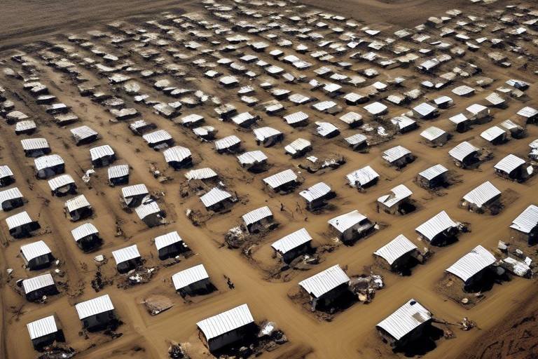
Geospatial Mapping Tools
In the realm of disaster response, have emerged as game-changers, providing critical insights that can make a significant difference in the effectiveness of aid delivery. Imagine a bird's-eye view of a disaster-stricken area, where every detail is mapped out in real-time. This is exactly what geospatial technologies offer. By utilizing satellite data, aerial imagery, and geographic information systems (GIS), responders can visualize the landscape and pinpoint areas that require immediate attention.
One of the most compelling aspects of these tools is their ability to create detailed visual representations of affected regions. This not only enhances situational awareness but also allows for the identification of critical zones that may be overlooked without such technology. For instance, a mapping tool can highlight regions with high population density that are at risk of flooding, or areas where infrastructure has been severely damaged, enabling responders to prioritize their efforts effectively.
Moreover, the integration of geospatial mapping with real-time data feeds enhances the decision-making process during emergencies. When combined with other technologies like drones, these tools can provide a comprehensive overview of the situation on the ground. Responders can quickly assess the extent of damage and allocate resources where they are needed the most, ensuring that no time is wasted in delivering aid.
To illustrate the impact of geospatial mapping tools, consider the following table that outlines some key features and benefits:
| Feature | Benefit |
|---|---|
| Real-time Data Integration | Allows for timely updates and adjustments to response strategies. |
| Visual Representation | Helps responders quickly identify areas of need and prioritize actions. |
| Resource Allocation | Ensures efficient use of resources by directing them to critical zones. |
| Improved Coordination | Facilitates collaboration among various agencies and organizations. |
In addition to these features, geospatial mapping tools also play a vital role in post-disaster recovery. By analyzing the data collected during the disaster, organizations can learn from the event and improve their strategies for future incidents. This continuous cycle of learning and adaptation is crucial for building resilience within communities, ensuring that they are better prepared for whatever challenges lie ahead.
As we move forward in an increasingly unpredictable world, the importance of geospatial mapping tools cannot be overstated. They not only enhance the immediate response but also lay the groundwork for long-term recovery and preparedness. In a way, these tools act like a compass in the chaos, guiding responders through the fog of uncertainty and helping them navigate the complexities of disaster relief.
- What are geospatial mapping tools?
Geospatial mapping tools are technologies that provide visual representations of geographic areas, helping responders assess situations during disasters. - How do geospatial mapping tools improve disaster response?
They enhance situational awareness, allow for better resource allocation, and improve coordination among response teams. - Can geospatial mapping tools be used for recovery efforts?
Yes, they are essential for analyzing damage and planning recovery strategies post-disaster.

Satellite Imagery Applications
In the realm of disaster response, satellite imagery stands out as a game-changer, providing critical insights that can literally save lives. When disaster strikes, the immediate aftermath can be chaotic and disorienting. This is where satellite technology comes into play, offering a bird’s-eye view of the affected areas. Imagine being able to see the extent of the damage from space—this is precisely what satellite imagery allows us to do. It helps responders understand the scale of destruction and assess the needs of the population on the ground.
One of the most significant advantages of satellite imagery is its ability to provide real-time data. As satellites orbit the Earth, they capture high-resolution images that can reveal vital information about infrastructure damage, changes in land use, and even the movement of displaced populations. For instance, after a hurricane, satellite images can show which roads are impassable, where buildings have collapsed, and how many people might be stranded. This information is crucial for directing resources and aid where they are needed most.
Moreover, satellite imagery is not just about immediate response; it also plays a vital role in strategic planning and recovery efforts. By analyzing historical satellite data, organizations can identify patterns and trends that inform future disaster preparedness strategies. For example, understanding how certain regions have been affected by past disasters can help in creating more resilient infrastructures, such as flood defenses or improved urban planning.
To illustrate the impact of satellite imagery, consider the following applications:
- Damage Assessment: Satellite images allow responders to assess damage quickly and accurately, enabling faster decision-making.
- Resource Allocation: By identifying the most affected areas, aid organizations can prioritize their efforts and allocate resources efficiently.
- Monitoring Recovery: Satellites can track the progress of recovery efforts over time, helping to ensure that aid is effective and reaching those in need.
Additionally, the integration of machine learning with satellite imagery is paving the way for even more sophisticated analysis. Algorithms can automatically detect changes in landscapes, such as the emergence of new buildings or the destruction of others, providing invaluable data for both immediate response and long-term recovery planning. This synergy between technology and humanitarian efforts exemplifies how innovation can enhance our ability to respond to crises with speed and precision.
In conclusion, the applications of satellite imagery in disaster response are vast and varied. They not only provide essential information during emergencies but also contribute to building a more resilient future. As technology continues to evolve, the potential for satellite imagery to transform disaster relief efforts will only grow, making it an indispensable tool in the fight against natural disasters.
- How often do satellites capture images of disaster-affected areas?
Satellites can capture images multiple times a day, depending on their orbit and the specific satellite technology used. - Are satellite images available to the public?
Yes, many satellite images are available to the public through various platforms and organizations, often for free or at a low cost. - How is satellite imagery used in disaster recovery?
Satellite imagery is used to assess damage, plan recovery efforts, and monitor the rebuilding process over time.

Mobile Mapping Solutions
In the chaotic aftermath of a disaster, every second counts. This is where come into play, acting as a lifeline for on-the-ground responders. Imagine a scenario where a community is struck by a devastating earthquake. Traditional methods of gathering information may take hours, if not days, to provide a clear picture of the situation. However, with mobile mapping technology, responders can gather and share critical data in real-time, significantly enhancing their ability to act swiftly and effectively.
Mobile mapping solutions utilize a combination of GPS technology, smartphones, and specialized software to create detailed maps that can be updated instantly. This technology allows responders to pinpoint locations of affected individuals, identify damaged infrastructure, and assess the overall situation more accurately. For instance, a volunteer equipped with a mobile mapping app can quickly mark areas where people are in need of medical assistance or where resources are lacking. This immediate feedback loop is vital for efficient resource allocation.
Moreover, these solutions enhance communication among various agencies involved in disaster response. By sharing real-time data through mobile platforms, organizations can coordinate their efforts more effectively. Imagine multiple agencies working together, each with their own data sets. Without mobile mapping, the chances of miscommunication or duplicated efforts are high. However, with a unified mobile mapping system, everyone is on the same page, literally and figuratively.
In addition to improving response times, mobile mapping solutions also play a significant role in post-disaster assessments. Once the initial chaos has subsided, responders can use the data collected during the crisis to analyze the effectiveness of their efforts. This analysis can lead to valuable insights that inform future disaster planning and preparedness strategies. For example, if certain areas were consistently highlighted as needing assistance, organizations can focus on those zones for future training and resource allocation.
To illustrate the impact of mobile mapping, consider the following table showcasing key benefits:
| Benefit | Description |
|---|---|
| Real-Time Data Collection | Immediate updates on the status of affected areas, allowing for rapid response. |
| Enhanced Coordination | Facilitates better communication among various agencies and responders. |
| Post-Disaster Analysis | Provides data for assessing response effectiveness and improving future strategies. |
In conclusion, mobile mapping solutions are not just a technological advancement; they are a game-changer in disaster response efforts. By empowering responders with the tools they need to gather and share information quickly, these solutions ensure that aid reaches those who need it most, when they need it. As we continue to innovate and integrate technology into disaster relief efforts, the potential for saving lives and improving outcomes becomes even greater.
- What are mobile mapping solutions? Mobile mapping solutions use GPS technology and smartphones to gather and share real-time data during disasters.
- How do they improve disaster response? They allow responders to quickly assess situations, coordinate efforts, and allocate resources efficiently.
- Can mobile mapping be used after a disaster? Yes, it is valuable for post-disaster assessments and improving future response strategies.

Communication Technologies in Crisis
In the chaos of a disaster, effective communication can be the lifeline that connects those in need with the help they require. Imagine a scenario where a community is struck by a natural disaster—homes are destroyed, and panic ensues. In such moments, communication technologies become indispensable. They not only facilitate coordination among various response agencies but also ensure that accurate information reaches those affected swiftly.
For instance, mobile networks can be quickly restored or set up in disaster zones, allowing for seamless communication. Emergency services can share real-time updates on the situation, while individuals can report their needs and conditions. Social media platforms also play a significant role, acting as a bridge between responders and the community. Through these platforms, people can share their experiences, post requests for help, and even provide updates on the status of affected areas. This flow of information is crucial for effective disaster management.
Moreover, technologies like satellite phones and two-way radios become vital tools when traditional communication infrastructure fails. These devices can function in challenging environments where cellular networks are down, ensuring that responders can maintain contact with each other and coordinate relief efforts. This is particularly important in remote or hard-to-reach areas where disasters may have disrupted local infrastructure.
To illustrate the impact of communication technologies in crisis situations, consider the following table that outlines various technologies and their benefits:
| Technology | Benefits |
|---|---|
| Mobile Networks | Enables real-time communication and updates |
| Social Media Platforms | Facilitates information sharing and community engagement |
| Satellite Phones | Provides communication in areas without cellular coverage |
| Two-Way Radios | Ensures communication between responders in remote locations |
Ultimately, the importance of communication technologies in crisis situations cannot be overstated. They enhance the efficiency of disaster response efforts, ensuring that resources are allocated where they are most needed and that the affected population is kept informed. As we look to the future, it is clear that investing in these technologies will not only improve our disaster preparedness but also strengthen our resilience in the face of adversity.
- What role do communication technologies play in disaster management?
Communication technologies facilitate coordination among response agencies, provide real-time updates, and ensure that accurate information reaches affected individuals. - How do social media platforms contribute during a crisis?
They allow individuals to share experiences, request help, and provide updates on the situation, enhancing community engagement and situational awareness. - What are some examples of communication technologies used in disasters?
Examples include mobile networks, satellite phones, two-way radios, and social media platforms, all of which serve different communication needs in a crisis.

Community Engagement and Technology
In today's world, community engagement has become a cornerstone of effective disaster management. When disasters strike, the response is not just about the resources deployed; it’s also about the people affected and their ability to mobilize and support each other. Technology plays a crucial role in this engagement, transforming how communities prepare for, respond to, and recover from crises. Imagine a neighborhood where every individual has a smartphone app that connects them to local resources, emergency services, and even each other. This is not just a dream; it’s becoming a reality.
One of the most exciting developments in this space is the rise of mobile applications designed specifically for disaster preparedness and response. These apps empower individuals to report real-time needs, share information about local hazards, and coordinate with relief agencies. For instance, during a flood, residents can use these applications to alert authorities about blocked roads or rising water levels, providing critical data that can help save lives. This kind of immediate feedback loop is invaluable, as it enhances the situational awareness of both responders and the community.
Moreover, social media platforms have become powerful tools for community engagement during disasters. They allow individuals to share their experiences, seek help, and offer support. For example, during a wildfire, a Facebook group can serve as a hub for sharing evacuation routes, shelter locations, and volunteer opportunities. This kind of real-time communication creates a sense of solidarity among community members, fostering resilience and preparedness.
To illustrate the impact of technology on community engagement, let’s look at a few key benefits:
- Empowerment: Individuals feel more in control and capable of contributing to their community's safety.
- Real-time information: Access to immediate updates helps residents make informed decisions during emergencies.
- Resource mobilization: Technology facilitates the rapid gathering and distribution of resources where they are needed most.
Additionally, training and capacity building are vital components of using technology for community engagement. Online courses and simulations prepare volunteers and responders for real-life scenarios, ensuring they know how to use the tools at their disposal effectively. For example, a community might conduct a virtual training session on how to use a specific disaster management app, ensuring everyone is on the same page when an emergency occurs. This proactive approach not only enhances individual skills but also strengthens the entire community’s response capability.
In conclusion, the intersection of technology and community engagement is reshaping the landscape of disaster management. By harnessing the power of mobile applications, social media, and training resources, communities are becoming more resilient and better equipped to face the challenges of disasters. As we move forward, it’s essential to continue fostering these connections and leveraging technology to ensure that every voice is heard, and every need is met.
Q: How can technology help in community engagement during disasters?
A: Technology facilitates real-time communication, empowers individuals to report needs, and enhances coordination among community members and responders.
Q: What role do mobile applications play in disaster preparedness?
A: Mobile applications provide platforms for individuals to share information, receive alerts, and access resources, making them invaluable during emergencies.
Q: How does social media contribute to disaster response?
A: Social media allows for rapid information sharing and community support, enabling residents to coordinate efforts and stay informed during crises.
Q: Why is training important for community members in disaster situations?
A: Training equips individuals with the knowledge and skills needed to respond effectively during disasters, improving overall community resilience.

Crowdsourcing Information
Crowdsourcing information during disasters is like harnessing the collective power of a community to create a real-time response network. Imagine a bustling hive where each bee contributes to the survival of the colony; similarly, every individual can provide valuable insights that enhance situational awareness for responders. This approach not only democratizes information but also empowers citizens to play an active role in their own safety and recovery.
During times of crisis, traditional communication channels can become overwhelmed or even fail entirely. Crowdsourcing offers a solution by utilizing mobile apps and social media platforms, allowing individuals on the ground to report conditions, needs, and damages instantly. For instance, platforms like Twitter and Facebook can be used to share urgent updates, while dedicated apps can collect specific data related to food shortages, medical needs, and shelter availability.
One notable example of successful crowdsourcing in disaster response is the Ushahidi platform, which originated in Kenya. This tool allows users to map incidents of violence, but its application has expanded to include disaster response. By enabling citizens to report issues via SMS or web, responders can visualize the most affected areas and prioritize their efforts accordingly. This was particularly evident during the 2010 Haiti earthquake, where local reports helped guide international aid efforts.
Moreover, crowdsourcing can significantly enhance the efficiency of resource allocation. When responders receive real-time updates from the community, they can quickly identify where assistance is most needed. This not only saves time but also ensures that resources are directed to the right places, maximizing their impact. For example, if a community reports a sudden influx of displaced individuals, aid organizations can mobilize food, water, and medical supplies to that location without delay.
However, it’s essential to implement proper verification mechanisms to ensure the accuracy of the information being shared. Misinformation can lead to misallocation of resources and potentially exacerbate the situation. Therefore, organizations must develop strategies to validate the data collected through crowdsourcing. This could involve cross-referencing reports with official data or utilizing AI algorithms to analyze patterns in the information being submitted.
In conclusion, crowdsourcing information during disasters not only empowers individuals but also transforms the way aid is delivered. By leveraging technology to collect and disseminate real-time data, communities can enhance their resilience and ensure that help reaches those who need it most. As we continue to innovate and refine these systems, the potential for improved disaster response becomes even greater, creating a future where no one is left behind in times of crisis.
- What is crowdsourcing in disaster response? Crowdsourcing in disaster response involves gathering information from the public to enhance situational awareness and improve the efficiency of aid delivery during emergencies.
- How does technology facilitate crowdsourcing? Technology, through mobile apps and social media, allows individuals to report real-time information about their conditions, needs, and damages, which can be analyzed and acted upon by responders.
- What are some examples of successful crowdsourcing initiatives? Notable examples include the Ushahidi platform, which has been used in various disasters worldwide, including the 2010 Haiti earthquake.
- How can misinformation be prevented in crowdsourced data? Implementing verification mechanisms, such as cross-referencing reports and using AI for data analysis, can help ensure the accuracy of crowdsourced information.

Training and Capacity Building
In the world of disaster relief, are crucial components that can make or break a response effort. Imagine a well-oiled machine, where every part works in perfect harmony; that's what effective training does for disaster response teams. With the rapid advancement of technology, new tools and methods are emerging to ensure that volunteers and responders are not just prepared, but are also equipped to handle the unexpected challenges that disasters often present.
One of the most exciting developments in this area is the use of online courses and simulations. These resources allow individuals to learn at their own pace, making training accessible to a wider audience. For instance, organizations can leverage platforms that offer interactive simulations of disaster scenarios, where trainees can practice their decision-making skills in a safe environment. This hands-on experience is invaluable, as it helps build confidence and readiness among volunteers who may find themselves in high-stress situations during actual disasters.
Moreover, training programs often include virtual reality (VR) elements, which immerse participants in realistic disaster scenarios. Picture this: a volunteer puts on a VR headset and suddenly finds themselves in a simulated earthquake zone, where they must navigate debris and coordinate rescue efforts. This kind of training not only enhances practical skills but also fosters teamwork and communication among responders. The more realistic the training, the better prepared individuals will be when real disasters strike.
Additionally, community engagement plays a vital role in training and capacity building. Local residents are often the first responders during a disaster, and empowering them with the right skills can significantly enhance community resilience. Workshops and training sessions can be organized to teach essential skills such as first aid, emergency response planning, and effective communication during crises. By involving the community, organizations not only build a stronger network of responders but also create a sense of ownership and responsibility towards disaster preparedness.
To further illustrate the impact of training and capacity building, consider the following table that outlines the key components of effective training programs:
| Training Component | Description | Benefits |
|---|---|---|
| Online Courses | Accessible training modules covering various disaster response topics. | Flexible learning, wide reach, and updated content. |
| Simulations | Interactive scenarios that mimic real-life disaster situations. | Hands-on experience, improved decision-making skills. |
| Community Workshops | Local training sessions focused on emergency preparedness. | Empowered communities, enhanced local response capabilities. |
In conclusion, the integration of technology in training and capacity building is transforming disaster relief efforts. By leveraging innovative tools and engaging communities, we can create a network of prepared individuals ready to respond effectively when the need arises. The more we invest in training today, the more lives we can save tomorrow.
- What types of training are available for disaster response volunteers?
There are various training options, including online courses, in-person workshops, and simulation exercises that cover essential skills for disaster response. - How can technology improve disaster training?
Technology enhances disaster training through virtual reality simulations, online learning platforms, and real-time data sharing, making training more engaging and effective. - Why is community engagement important in disaster training?
Community engagement ensures that local residents are prepared to respond quickly and effectively in emergencies, leveraging their knowledge of the area.
Frequently Asked Questions
- How are drones used in disaster relief efforts?
Drones are game-changers in disaster relief! They can quickly survey affected areas, providing real-time aerial footage that helps responders assess damage and identify the most critical zones. This information is crucial for making quick decisions about where to send aid first, ultimately saving more lives.
- What role does AI play in disaster management?
AI enhances disaster management by analyzing vast amounts of data to predict needs and optimize resource allocation. For instance, it can forecast which areas are likely to be hit hardest, allowing organizations to pre-position supplies and personnel, leading to faster and more effective responses.
- How does data analytics improve decision-making during disasters?
Data analytics provides insights that are simply invaluable during emergencies. By analyzing real-time data, organizations can make informed decisions about where to focus their efforts, ensuring that resources are allocated effectively to meet the needs of those affected.
- What are geospatial mapping tools, and why are they important?
Geospatial mapping tools offer detailed visual representations of disaster-affected areas. They help responders identify critical zones and prioritize their efforts. Think of them as a GPS for disaster relief, guiding teams to where they’re needed most.
- How does satellite imagery assist in disaster response?
Satellite imagery provides a bird's-eye view of disaster areas, allowing responders to assess damage and track changes over time. This information is vital for strategic planning and resource deployment, helping teams understand the evolving situation on the ground.
- What are mobile mapping solutions?
Mobile mapping solutions enable responders on the ground to gather and share data in real-time. This technology enhances communication among teams and ensures that aid is directed where it is most needed, making the response more efficient and effective.
- Why is communication technology crucial during crises?
Effective communication is the backbone of disaster response. New technologies facilitate better coordination among agencies and ensure that accurate information reaches those affected. This clarity helps streamline efforts and improves overall response times.
- How can communities engage with technology during disasters?
Engaging local communities through technology fosters resilience and preparedness. Mobile applications and social media platforms empower individuals to report needs and mobilize resources, making it easier for responders to understand and address the community's specific requirements.
- What is crowdsourcing, and how does it help in disaster situations?
Crowdsourcing allows citizens to contribute vital information during disasters. This collective intelligence enhances situational awareness, helping responders assess the needs of affected populations more accurately and efficiently.
- How does technology aid in training for disaster response?
Technology plays a significant role in training volunteers and responders. Online courses and simulations prepare individuals to act swiftly and efficiently in the face of disasters, leading to improved community resilience and better overall outcomes during emergencies.


