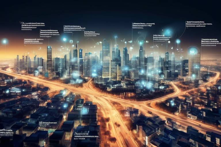
How Technology is Reshaping Disaster Risk Reduction
In today's fast-paced world, the impact of technology on disaster risk reduction is nothing short of revolutionary. Imagine a world where natural disasters can be predicted, monitored, and managed with unprecedented precision. This is not just a dream; it's the reality we are moving towards, thanks to the integration of advanced technologies. With tools ranging from big data analytics to artificial intelligence, we are witnessing a transformation in how communities prepare for and respond to disasters. This article delves into the various technological innovations that are enhancing disaster risk reduction strategies, enabling better preparedness and response to natural calamities.
Big data analytics is at the forefront of this technological evolution. By analyzing vast amounts of data, we can uncover patterns and trends that were previously invisible to us. For instance, data collected from various sources, including weather patterns, historical disaster records, and population density, can be synthesized to create predictive models. These models allow authorities to forecast potential disasters more accurately, facilitating timely interventions. The power of big data lies in its ability to enhance response effectiveness, ensuring that resources are allocated efficiently during emergencies. Imagine being able to predict a hurricane's path with pinpoint accuracy—this is the kind of insight that big data provides.
Remote sensing technologies, such as satellites and drones, have revolutionized the way we collect and monitor data in real-time. These tools are crucial for assessing the impact of disasters and guiding response efforts in affected areas. For example, satellites can capture images of disaster-stricken regions, providing vital information about damage levels and infrastructure status. Drones, on the other hand, can navigate hard-to-reach areas, delivering real-time footage that can aid rescue operations. The ability to gather data from above not only enhances situational awareness but also allows for more informed decision-making during crises.
In our increasingly mobile world, mobile applications have become essential in disseminating timely emergency alerts. These apps empower individuals and communities to respond quickly and effectively during disasters. By sending push notifications about impending threats or safety measures, mobile technology ensures that critical information reaches those who need it most. For instance, imagine receiving an alert on your phone about a nearby earthquake just moments before it strikes. Such technology not only saves lives but also fosters a culture of preparedness within communities.
Geographic Information Systems (GIS) mapping plays a pivotal role in disaster risk assessment. By providing valuable visualizations of hazard zones and vulnerable populations, GIS aids in planning disaster management initiatives. This technology allows decision-makers to identify high-risk areas and allocate resources accordingly. For example, a city could use GIS to map flood-prone neighborhoods, enabling them to develop targeted evacuation plans. The ability to visualize risks enhances understanding and promotes proactive measures, ultimately leading to safer communities.
Social media platforms have emerged as powerful tools for rapid information sharing during disasters. They facilitate community engagement and enable individuals to stay informed and connected. During a crisis, social media can serve as a lifeline, providing real-time updates and fostering collaboration among response agencies. Imagine a scenario where citizens share live updates about road conditions or safety resources through social media—this grassroots communication can significantly enhance situational awareness and community resilience.
Artificial intelligence (AI) is enhancing predictive modeling capabilities, allowing for improved forecasting of disaster events. By analyzing historical data and recognizing patterns, AI can help predict when and where disasters are likely to occur. This capability is invaluable for planning and resource allocation during disaster response. For example, AI algorithms can analyze meteorological data to predict severe weather events, enabling authorities to issue warnings in advance. The integration of AI into disaster risk reduction strategies represents a significant leap forward in our ability to manage crises effectively.
Technological innovations in infrastructure design and construction are also improving resilience against disasters. Advanced materials and engineering techniques ensure that critical facilities, such as hospitals and emergency centers, can withstand extreme events. For instance, buildings designed with seismic-resistant features can better endure earthquakes, minimizing damage and ensuring continuity of services during emergencies. These innovations not only protect lives but also enhance the overall resilience of communities.
Technology fosters community engagement in disaster risk reduction efforts, empowering local populations to participate actively in preparedness initiatives. Online platforms and mobile apps can facilitate training sessions, simulations, and community drills, ensuring that everyone knows how to respond during a crisis. By involving communities in the planning process, we create a culture of resilience where individuals are informed and prepared for potential disasters. This participatory approach not only strengthens community ties but also enhances overall disaster readiness.
Despite its many benefits, the integration of technology in disaster risk reduction is not without challenges. Accessibility issues, particularly in underserved communities, can hinder the effectiveness of tech-based solutions. Additionally, concerns regarding data privacy and security must be addressed to gain public trust. Furthermore, continuous training and support are essential for effective implementation. Without proper education on how to use these technologies, their potential remains untapped. Acknowledging these challenges is crucial for maximizing the impact of technology in disaster risk reduction.
- How does technology improve disaster preparedness? Technology enhances disaster preparedness through better forecasting, real-time data collection, and community engagement.
- What role does social media play during disasters? Social media facilitates rapid information sharing and community engagement, helping individuals stay informed and connected.
- What are the challenges of using technology in disaster risk reduction? Challenges include accessibility issues, data privacy concerns, and the need for continuous training and support.

The Role of Big Data
In today's digital age, big data analytics is revolutionizing the way we approach disaster risk reduction. Imagine having access to a treasure trove of information that can predict the next big storm or earthquake. That's the power of big data! By analyzing vast amounts of information, experts can uncover patterns and trends that were previously hidden, allowing for better forecasting and resource allocation during emergencies. This means that when disaster strikes, response teams can be better prepared, leading to improved effectiveness in their efforts.
For instance, consider how meteorologists use big data to track weather patterns. They analyze historical data, current conditions, and even social media trends to make accurate predictions about severe weather events. This not only helps in issuing timely warnings but also in mobilizing resources where they're needed most. The integration of big data into disaster management strategies can be likened to having a crystal ball that provides insights into potential risks and vulnerabilities.
Furthermore, big data aids in risk assessment by identifying vulnerable populations and high-risk areas. This information is crucial for governments and organizations to develop targeted interventions. For instance, by analyzing demographic data, officials can ascertain which communities are most at risk during a flood or earthquake and prioritize them for evacuation or resource distribution. The ability to visualize this data through advanced analytics tools allows for more informed decision-making.
However, it's not just about collecting data; it's also about how we use it. The real challenge lies in transforming raw data into actionable insights. This requires sophisticated algorithms and analytics tools that can process and interpret the information effectively. Organizations are increasingly turning to platforms that specialize in big data analytics to help them navigate through the complexities of data interpretation.
To illustrate the impact of big data on disaster risk reduction, let's take a look at a simple table that summarizes its benefits:
| Benefit | Description |
|---|---|
| Improved Forecasting | Analyzing historical and real-time data to predict disasters more accurately. |
| Resource Allocation | Identifying where resources are needed most during an emergency. |
| Vulnerability Assessment | Pinpointing at-risk populations and areas for targeted intervention. |
| Enhanced Communication | Facilitating faster and clearer communication among response teams. |
In conclusion, the integration of big data into disaster risk reduction strategies is not just a technological advancement; it's a game changer. By leveraging the insights gained from big data, communities can enhance their preparedness and response capabilities, ultimately saving lives and minimizing damage. As we continue to innovate and refine our use of big data, the future of disaster management looks promising, with the potential for even greater advancements on the horizon.

Remote Sensing Technologies
This article explores the transformative role of technology in enhancing disaster risk reduction strategies, focusing on innovative tools, data analytics, and community engagement that improve preparedness and response to natural disasters.
Big data analytics revolutionizes disaster risk reduction by providing insights into patterns and trends, allowing for better forecasting and resource allocation during emergencies, ultimately enhancing response effectiveness.
In the realm of disaster risk reduction, have emerged as game changers. These technologies, which include satellites and drones, enable us to collect real-time data that is invaluable during natural disasters. Imagine being able to see a storm brewing from space or using a drone to assess flood damage in a remote area—this is the power of remote sensing. By providing accurate and timely information, these technologies allow response teams to make informed decisions quickly, ultimately saving lives and resources.
For instance, satellites can monitor environmental changes and track weather patterns, providing crucial data that helps in predicting disasters such as hurricanes or wildfires. Drones, on the other hand, can be deployed in the aftermath of a disaster to assess damage and identify areas in need of immediate assistance. This rapid assessment capability is vital for effective disaster response.
Moreover, the data collected through remote sensing technologies can be integrated with other systems, such as Geographic Information Systems (GIS), to create comprehensive maps that highlight affected areas and vulnerable populations. This integration enhances situational awareness and facilitates better planning for future disasters. The following table illustrates some key applications of remote sensing technologies in disaster management:
| Technology | Application | Benefits |
|---|---|---|
| Satellites | Monitoring weather patterns | Early warning and forecasting |
| Drones | Damage assessment | Rapid response and resource allocation |
| Remote Sensing | Environmental monitoring | Understanding risk factors |
In conclusion, remote sensing technologies are not just tools; they are critical allies in the fight against the devastating effects of natural disasters. By harnessing their capabilities, we can enhance our preparedness and response strategies, ultimately leading to more resilient communities. So the next time you think about disaster management, remember that looking down from above can provide insights that save lives.
Mobile applications play a vital role in disseminating timely emergency alerts and information, empowering individuals and communities to respond quickly and effectively during disasters.
Geographic Information Systems (GIS) mapping provides valuable visualizations of hazard zones and vulnerable populations, aiding in risk assessment and planning for disaster management initiatives.
Social media platforms facilitate rapid information sharing and community engagement during disasters, enabling individuals to stay informed and connected while fostering collaboration among response agencies.
Artificial intelligence enhances predictive modeling capabilities, allowing for improved forecasting of disaster events and more effective planning and resource allocation for disaster response.
Technological innovations in infrastructure design and construction improve resilience against disasters, ensuring that critical facilities can withstand extreme events and continue to function during emergencies.
Technology fosters community engagement in disaster risk reduction efforts, empowering local populations to participate actively in preparedness initiatives and enhancing overall community resilience.
Despite its benefits, the integration of technology in disaster risk reduction faces challenges, including accessibility issues, data privacy concerns, and the need for continuous training and support for effective implementation.
- What are remote sensing technologies?
Remote sensing technologies include tools like satellites and drones that collect data about the Earth's surface, crucial for disaster monitoring and response. - How do drones assist in disaster management?
Drones provide real-time imagery and data for assessing damage, allowing for quick decision-making and resource allocation. - Can remote sensing technologies predict disasters?
While they cannot predict disasters with absolute certainty, they can provide valuable data that helps in forecasting potential events. - What role does GIS play in disaster risk reduction?
GIS mapping visualizes hazard zones and vulnerable populations, aiding in risk assessment and planning for effective disaster management.

Mobile Applications for Emergency Alerts
In today's fast-paced world, where information travels at lightning speed, mobile applications have emerged as a **lifeline** during emergencies. These apps are not just convenient; they are essential tools that empower individuals and communities to respond quickly and effectively in the face of disasters. Imagine being in the middle of a natural calamity, and your phone buzzes with a timely alert, guiding you on what to do next. This is the power of mobile applications for emergency alerts.
Mobile applications serve as a direct line of communication between authorities and the public. They provide real-time updates on various emergencies, such as floods, hurricanes, earthquakes, and fires. By leveraging GPS technology, these apps can deliver personalized alerts based on your location, ensuring that you receive the most relevant information. For instance, if a tornado warning is issued in your area, your app will notify you instantly, giving you precious time to take cover.
Furthermore, many of these applications offer a range of features that enhance safety and preparedness. Users can access vital information such as:
- Evacuation routes and shelter locations
- Emergency contact lists
- First aid tips and resources
- Live weather updates and forecasts
This comprehensive approach not only keeps individuals informed but also equips them with the tools necessary to make informed decisions during crises. In a world where every second counts, having this information at your fingertips can mean the difference between safety and disaster.
Moreover, mobile applications foster community engagement by allowing users to share information and updates with their neighbors and local authorities. This collaborative approach enhances situational awareness and encourages a **sense of solidarity** among community members. Imagine a scenario where a user posts about a roadblock due to flooding, and others in the area can quickly adjust their travel plans accordingly. This real-time information exchange can significantly improve response efforts and reduce panic during emergencies.
However, while the benefits of mobile applications for emergency alerts are clear, it’s essential to recognize some challenges. Not everyone has access to smartphones or reliable internet connections, which can create disparities in information dissemination. Additionally, users must ensure that their apps are updated to receive the latest alerts. This highlights the importance of **digital literacy** and accessibility in disaster preparedness strategies.
In conclusion, mobile applications for emergency alerts are transforming the way we prepare for and respond to disasters. They provide critical information, enhance community engagement, and ultimately save lives. As technology continues to evolve, it will be exciting to see how these tools further develop and integrate into our disaster risk reduction frameworks. So, the next time you hear about a new emergency app, consider downloading it; it might just be your best defense in a crisis.
Q: How can I ensure I receive alerts from emergency apps?
A: Make sure to enable notifications for the app and allow location services so you can receive alerts relevant to your area.
Q: Are there specific apps recommended for my region?
A: Yes, many local governments and organizations develop their own emergency alert apps. Check with your local emergency management office for recommendations.
Q: What should I do if I don’t have a smartphone?
A: Consider using traditional methods of receiving alerts, such as NOAA Weather Radio or local news stations, which provide updates during emergencies.

GIS Mapping for Risk Assessment
Geographic Information Systems (GIS) mapping has emerged as a game-changer in the realm of disaster risk assessment. By providing a visual representation of geographical data, GIS allows for a comprehensive analysis of hazard zones and vulnerable populations. Imagine trying to find your way through a dense fog without a map; that’s what disaster planners face without GIS. This technology serves as a guiding light, illuminating the areas most at risk and enabling effective planning and resource allocation.
One of the most significant advantages of GIS mapping is its ability to integrate various data sources. This includes demographic information, historical disaster data, and environmental factors. By layering these datasets, decision-makers can visualize complex relationships and trends that might otherwise go unnoticed. For instance, a GIS map can highlight regions where low-income communities are situated near flood-prone areas, allowing for targeted interventions and preparedness measures.
Moreover, GIS mapping is not just about identifying risks; it also plays a crucial role in the planning phase of disaster management. It helps in:
- Identifying critical infrastructure: Mapping out hospitals, schools, and emergency services to ensure they are adequately protected and accessible during disasters.
- Assessing evacuation routes: Visualizing the best pathways for evacuating residents in case of an emergency.
- Resource allocation: Determining where to deploy resources effectively, ensuring that aid reaches those who need it most.
Furthermore, GIS mapping fosters community engagement. Local populations can contribute their insights, making the data more robust and reflective of the community's needs. This collaboration not only enhances the quality of the data but also empowers residents, making them active participants in their safety and preparedness efforts.
However, it’s essential to recognize that GIS mapping is not without its challenges. Data accuracy and accessibility can be significant hurdles. In many regions, especially in developing countries, the lack of up-to-date information can hinder effective mapping. Additionally, there is a need for training and resources to ensure that local authorities can utilize GIS technology effectively.
In conclusion, GIS mapping is a powerful tool that significantly enhances disaster risk assessment. By providing critical insights and fostering community involvement, it paves the way for more effective disaster management strategies. As technology continues to evolve, the integration of GIS into disaster risk reduction efforts will undoubtedly become even more crucial, ensuring that communities are better prepared for the unpredictable nature of disasters.
1. What is GIS mapping?
GIS mapping refers to the use of Geographic Information Systems to analyze and visualize spatial data. It helps in understanding relationships between different data sets, particularly in the context of disaster risk assessment.
2. How does GIS mapping improve disaster preparedness?
By providing a visual representation of hazard zones and vulnerable populations, GIS mapping allows for better planning, resource allocation, and community engagement, ultimately enhancing disaster preparedness.
3. What are the challenges associated with GIS mapping?
Challenges include data accuracy, accessibility issues, and the need for training to effectively use GIS technology, especially in resource-limited settings.
4. Can communities participate in GIS mapping?
Yes! Community involvement is crucial for accurate data collection and can significantly enhance the effectiveness of GIS mapping in disaster risk reduction.

Social Media as a Communication Tool
In today's fast-paced digital world, social media has emerged as a powerful tool for communication, especially during disasters. Imagine a scenario where a natural disaster strikes—what's the first thing you do? You probably reach for your smartphone to check for updates. This is where platforms like Twitter, Facebook, and Instagram come into play, acting as lifelines that connect individuals with vital information and updates.
Social media allows for the rapid dissemination of information, which is crucial in times of crisis. During a disaster, agencies and organizations can instantly share updates, safety tips, and emergency alerts, reaching a vast audience in a matter of seconds. For instance, a tweet can inform thousands about an impending hurricane, while a Facebook post can provide real-time updates on evacuation routes. The immediacy of social media can mean the difference between safety and danger.
Moreover, social media platforms foster community engagement, enabling individuals to share their experiences and support each other. People often turn to these platforms to check on loved ones, offer assistance, or seek help. This sense of community is invaluable during disasters, as it creates a network of support that can help individuals cope with the emotional and physical challenges they face.
To illustrate the impact of social media in disaster situations, consider the following table, which highlights key benefits:
| Benefit | Description |
|---|---|
| Real-time Updates | Instant sharing of critical information such as weather alerts and evacuation orders. |
| Community Support | Facilitates connections among individuals, allowing for the sharing of resources and assistance. |
| Awareness and Education | Informs the public about disaster preparedness and response strategies. |
| Feedback Mechanism | Allows authorities to gauge public sentiment and needs during a crisis. |
However, while social media is a powerful tool, it is not without its challenges. Misinformation can spread just as quickly as accurate information, leading to confusion and panic. Therefore, it is essential for users to verify the information they receive and for authorities to provide clear and consistent messages. Additionally, the digital divide remains a concern, as not everyone has equal access to technology, potentially leaving some communities at a disadvantage during disasters.
In conclusion, social media serves as a vital communication tool in disaster risk reduction, enhancing information flow and community engagement. By leveraging these platforms effectively, we can create a more informed and resilient society, ready to face the challenges posed by natural disasters.
- How does social media help during a disaster? Social media allows for real-time updates, community engagement, and the rapid dissemination of critical information.
- What are the risks associated with social media during disasters? Misinformation can spread quickly, potentially causing panic and confusion among the public.
- How can I ensure I receive accurate information during a disaster? Always verify information through official sources and follow updates from credible organizations.

Artificial Intelligence in Predictive Modeling
Artificial Intelligence (AI) is revolutionizing the way we predict and prepare for disasters. Imagine having a crystal ball that not only tells you when a storm is coming but also predicts its intensity and potential impact. That's what AI brings to the table! By analyzing vast amounts of data from various sources, AI algorithms can identify patterns and trends that human analysts might overlook. This capability is crucial in disaster risk reduction, as it allows for more accurate forecasting and timely responses.
One of the most impressive aspects of AI in predictive modeling is its ability to learn from historical data. For instance, machine learning models can analyze past weather events, seismic activities, and even human behavior during disasters to create simulations of future occurrences. These simulations can help emergency management agencies make informed decisions about resource allocation and evacuation plans. The result? A more efficient and effective response to disasters.
Moreover, AI can process real-time data from various sensors and satellites, enhancing its predictive capabilities. For example, during a hurricane, AI can analyze wind patterns, precipitation levels, and ocean temperatures to predict the storm's trajectory and potential impact on different regions. This information is invaluable for local governments and disaster response teams, enabling them to take proactive measures to protect communities.
However, the integration of AI in predictive modeling is not without its challenges. Data quality and accessibility are significant issues. For AI to provide accurate predictions, it requires high-quality, comprehensive datasets. Unfortunately, in many regions, such data may be scarce or inconsistent. Additionally, there are concerns about the transparency of AI algorithms. Decision-makers need to understand how these models work to trust their predictions fully.
Despite these challenges, the potential benefits of AI in disaster management are immense. As technology continues to evolve, we can expect even more sophisticated predictive models that will improve our ability to prepare for and respond to disasters. In the future, we might see AI systems that can not only predict disasters but also suggest optimal response strategies based on real-time data.
In summary, AI is a game-changer in predictive modeling for disaster risk reduction. It enhances our forecasting abilities, improves resource allocation, and ultimately saves lives. As we continue to harness the power of AI, we can look forward to a future where communities are better prepared for whatever nature throws their way.
- What is predictive modeling in disaster management?
Predictive modeling involves using statistical techniques and algorithms to forecast potential disaster events based on historical and real-time data. - How does AI improve disaster prediction?
AI analyzes large datasets to identify patterns and trends, enabling more accurate forecasts and better decision-making during emergencies. - What are the challenges of using AI in disaster risk reduction?
Challenges include data quality, accessibility, and the need for transparency in AI algorithms to ensure trust in their predictions. - Can AI predict all types of disasters?
While AI can significantly enhance predictions for many types of disasters, its effectiveness depends on the availability of relevant data and the complexity of the event.

Innovations in Infrastructure Resilience
In today's world, where natural disasters seem to strike with increasing frequency and intensity, the need for resilient infrastructure has never been more critical. Innovations in this field are not just about repairing what’s broken but about designing systems that can withstand the forces of nature. Imagine a building that can sway like a tree in the wind or roads that can absorb the shock of an earthquake. These are not just dreams; they are becoming a reality through cutting-edge technology and innovative engineering practices.
One of the most exciting developments in infrastructure resilience is the use of smart materials. These materials can adapt to environmental changes, providing enhanced durability and flexibility. For instance, self-healing concrete contains microscopic capsules filled with healing agents that activate when cracks form, effectively sealing them and prolonging the structure's lifespan. This technology not only saves on repair costs but also reduces the need for frequent maintenance, allowing communities to focus resources on other critical areas.
Another significant innovation is the integration of modular construction techniques. This approach involves prefabricating building components off-site and then assembling them on location. The benefits are manifold: quicker construction times, less waste, and the ability to design structures that can be easily modified or relocated in response to changing environmental conditions. For example, during a flood, modular homes can be elevated or moved to safer ground, providing a flexible solution to disaster management.
Moreover, advancements in drainage systems and flood barriers are vital for urban areas prone to flooding. Innovative designs, such as permeable pavements that allow water to seep through and be absorbed by the ground, help to mitigate runoff and reduce the risk of flooding. Additionally, deployable flood barriers can be quickly set up to protect critical infrastructure during extreme weather events, ensuring that essential services remain operational.
But it doesn't stop there! The use of geospatial technology, including Geographic Information Systems (GIS), is revolutionizing how we plan and manage infrastructure. By mapping out vulnerable areas and analyzing data from past disasters, urban planners can make informed decisions about where to build and how to fortify existing structures. This proactive approach is essential for creating resilient communities that can bounce back more rapidly after a disaster strikes.
However, while these innovations are promising, they come with challenges. The initial costs of implementing advanced technologies can be daunting for many municipalities, especially those with limited budgets. Additionally, there is a need for ongoing research and development to ensure these innovations remain effective and relevant in the face of evolving climate challenges.
In conclusion, innovations in infrastructure resilience are not just about survival; they are about thriving in the face of adversity. As we continue to harness the power of technology and engineering, we can create a world where communities are not only prepared for disasters but can recover and rebuild stronger than ever. It's a journey that requires collaboration among governments, private sectors, and communities, all working together to forge a resilient future.
- What are smart materials? Smart materials are materials that can respond to environmental changes, such as temperature or pressure, enhancing durability and flexibility in construction.
- How does modular construction improve resilience? Modular construction allows for quicker assembly and flexibility in design, enabling structures to be easily modified or relocated in response to disasters.
- What role does GIS play in infrastructure planning? GIS technology helps urban planners identify vulnerable areas and make informed decisions about where to build and how to fortify structures.
- Are there costs associated with implementing these innovations? Yes, while innovative technologies can save money in the long run, the initial investment can be significant, especially for municipalities with limited resources.

Community Engagement through Technology
In today's fast-paced world, technology is not just a tool; it's a bridge that connects communities, especially in times of crisis. When it comes to disaster risk reduction, community engagement is paramount, and technology plays a pivotal role in fostering this connection. Imagine a scenario where every member of a community has access to real-time information about potential hazards, evacuation routes, and emergency contacts. This is not just a dream; it's becoming a reality thanks to technological advancements.
One of the most significant ways technology engages communities is through interactive platforms that allow for two-way communication. For instance, mobile applications and social media channels enable residents to share information about local risks and resources. This exchange of information is crucial, as it empowers individuals to take proactive measures. When people feel informed and involved, they are more likely to participate in disaster preparedness activities, such as drills and community meetings.
Moreover, technology can facilitate collaborative efforts among various stakeholders, including local governments, NGOs, and community members. For example, community forums held online can gather diverse perspectives, allowing for a more comprehensive understanding of local vulnerabilities and strengths. This collaborative approach not only enhances the planning process but also builds trust among community members and organizations. When people see that their voices matter, they are more likely to engage actively in disaster risk reduction initiatives.
Furthermore, technology opens up avenues for educational campaigns that raise awareness about disaster preparedness. Through engaging content, such as videos, infographics, and interactive quizzes shared on social media, communities can learn about the importance of being prepared in a fun and engaging way. For instance, a local government might launch a campaign that includes:
- Educational videos on emergency kits.
- Infographics detailing evacuation routes.
- Interactive quizzes to test knowledge on disaster preparedness.
This type of engagement not only educates but also encourages community members to share their knowledge with others, creating a ripple effect of awareness and preparedness.
However, while technology offers numerous benefits for community engagement, it's essential to recognize the challenges that come with it. Not everyone has equal access to technology, and disparities in digital literacy can hinder participation. Therefore, it's crucial for organizations to ensure that their technological solutions are inclusive and accessible to all community members. This might include providing training sessions on how to use specific apps or platforms, ensuring that information is available in multiple languages, and utilizing offline methods to reach those without internet access.
In conclusion, technology serves as a powerful ally in fostering community engagement for disaster risk reduction. By leveraging interactive platforms, promoting collaborative efforts, and enhancing educational campaigns, communities can become more resilient and prepared for potential disasters. The key lies in ensuring that these technological solutions are accessible and inclusive, allowing every voice to be heard and every individual to play a part in safeguarding their community.
Q1: How can I get involved in my community's disaster preparedness efforts?
A1: You can start by attending local meetings, joining community groups focused on disaster preparedness, or volunteering with organizations that work in this area.
Q2: What technology tools are most effective for community engagement?
A2: Tools like mobile apps for emergency alerts, social media platforms for information sharing, and community forums for discussions are highly effective.
Q3: Are there any challenges to using technology for community engagement?
A3: Yes, challenges include accessibility issues, digital literacy disparities, and the need for ongoing training to ensure effective use of technology.

Challenges and Limitations of Technology
While technology has undeniably transformed disaster risk reduction, it is not without its challenges and limitations. One of the primary concerns is accessibility. Not everyone has equal access to technology, especially in remote or underprivileged areas. This digital divide can create disparities in how communities prepare for and respond to disasters. Imagine a community that relies on mobile apps for emergency alerts, yet many residents lack smartphones or reliable internet access. This situation can lead to confusion and chaos during critical moments when timely information is essential.
Another significant challenge is data privacy. As technology collects vast amounts of data for analysis, concerns about who owns this data and how it is used can arise. For instance, when individuals share their location or personal information through emergency apps, they may inadvertently expose themselves to privacy breaches. Striking a balance between utilizing data for safety and protecting individual privacy is a complex issue that needs careful consideration.
Moreover, the implementation of technology in disaster risk reduction often requires continuous training and support. Technology evolves rapidly, and so do the tools and platforms used in disaster management. Without ongoing education and training, users may struggle to keep up with new systems or updates. This can hinder the effectiveness of technology during emergencies. For example, if a community has invested in a sophisticated GIS mapping tool but lacks trained personnel to operate it, the potential benefits may go unrealized.
Furthermore, there is the issue of reliability. Technology can fail, and systems can crash during critical times. Natural disasters can disrupt power supplies and communication networks, rendering technology useless when it is needed most. Relying solely on technological solutions without having backup plans can lead to dire consequences. Therefore, it is crucial to have redundant systems in place, ensuring that communities can still access vital information and support even when primary systems fail.
In addition to these challenges, there is also the risk of over-dependence on technology. While it can enhance disaster risk reduction efforts, an over-reliance can lead to complacency. Communities might neglect traditional methods of preparedness, such as community drills or local knowledge, assuming that technology will handle everything. This mentality can weaken overall resilience, as effective disaster response often requires a combination of modern technology and age-old practices.
In conclusion, while technology offers powerful tools for enhancing disaster risk reduction, it is essential to recognize and address its challenges. By understanding these limitations, we can work towards more inclusive, secure, and resilient systems that truly benefit all communities.
- What are the main challenges of using technology in disaster risk reduction? Accessibility, data privacy, the need for continuous training, reliability, and the risk of over-dependence are some of the main challenges.
- How can communities address the digital divide? Communities can invest in infrastructure, provide training, and develop programs that ensure everyone has access to the necessary technology.
- What role does training play in the effective use of technology? Continuous training ensures that users are familiar with the tools, maximizing their effectiveness during emergencies.
- Why is data privacy a concern in disaster management? Collecting and using personal data can lead to privacy breaches, making it essential to handle data responsibly.
Frequently Asked Questions
- How does big data enhance disaster risk reduction?
Big data analytics plays a pivotal role in disaster risk reduction by analyzing vast amounts of information to identify patterns and trends. This allows for better forecasting of potential disasters and more efficient allocation of resources during emergencies, ultimately leading to a more effective response.
- What are remote sensing technologies and how are they used in disaster management?
Remote sensing technologies, such as satellites and drones, provide real-time data collection and monitoring. These tools are essential for assessing the impact of disasters, allowing response teams to make informed decisions based on accurate and timely information.
- Can mobile applications really make a difference during emergencies?
Absolutely! Mobile applications are vital for disseminating timely emergency alerts and information. They empower individuals and communities to respond quickly and effectively, ensuring that everyone is informed about the situation and knows what actions to take.
- What role does GIS mapping play in disaster risk assessment?
Geographic Information Systems (GIS) mapping provides valuable visualizations of hazard zones and vulnerable populations. This information is crucial for risk assessment and helps in planning disaster management initiatives, making communities safer and more prepared.
- How has social media changed communication during disasters?
Social media platforms have revolutionized communication during disasters by facilitating rapid information sharing and community engagement. They enable individuals to stay informed, connect with others, and foster collaboration among response agencies, which is essential for effective disaster management.
- What is the impact of artificial intelligence on predictive modeling for disasters?
Artificial intelligence significantly enhances predictive modeling capabilities, allowing for improved forecasting of disaster events. This leads to more effective planning and resource allocation, ultimately saving lives and minimizing damage during emergencies.
- How do technological innovations improve infrastructure resilience?
Technological innovations in infrastructure design and construction enhance resilience against disasters. By ensuring that critical facilities can withstand extreme events, these innovations help maintain functionality during emergencies, which is crucial for community safety.
- In what ways does technology encourage community engagement in disaster risk reduction?
Technology fosters community engagement by empowering local populations to participate actively in disaster preparedness initiatives. This involvement enhances overall community resilience, making it easier for everyone to work together in times of crisis.
- What are some challenges associated with the integration of technology in disaster risk reduction?
While technology offers numerous benefits, its integration faces challenges such as accessibility issues, data privacy concerns, and the need for continuous training and support. Addressing these challenges is vital for ensuring effective implementation and maximizing the potential of technological solutions.