Future Trends in Disaster Preparedness Technologies
In an era where natural disasters seem to be increasing in frequency and intensity, the need for effective disaster preparedness technologies has never been more critical. The future of disaster preparedness is not just about reacting to emergencies but proactively preparing for them using cutting-edge innovations. As we delve into this exciting landscape, we'll uncover how emerging technologies are reshaping our response capabilities, enhancing communication, and fostering community resilience in the face of calamities.
Imagine a world where artificial intelligence can predict disasters before they happen, where smart sensors provide real-time data to first responders, and where drones fly overhead to assess damage in areas that are too dangerous for humans to enter. These technologies are not just dreams of the future; they are becoming integral parts of our disaster management strategies today. With the advent of the Internet of Things (IoT), we can collect and analyze data like never before, allowing for a more informed and coordinated response to disasters.
Moreover, satellite communication systems ensure that even in the most remote areas, connectivity is maintained during a disaster. This is crucial for coordinating rescue efforts and providing timely information to affected communities. As we explore these advancements, it's clear that the integration of technology into disaster preparedness is not just a trend; it's a necessity that can save lives and minimize damage.
As we look forward, the future trends in disaster preparedness technologies promise to transform how we prepare for, respond to, and recover from disasters. The collaboration between technology and human ingenuity will pave the way for a more resilient society. In the sections that follow, we will dive deeper into specific technologies that are leading this revolution, from AI and IoT to blockchain and mobile applications.
- What are the key technologies shaping disaster preparedness? Technologies such as artificial intelligence, IoT, drones, and blockchain are at the forefront of transforming disaster preparedness.
- How does AI improve disaster management? AI enhances decision-making through predictive analytics, allowing responders to anticipate needs and allocate resources efficiently.
- What role do drones play in disaster response? Drones are used for surveillance, delivering supplies, and assessing damage in inaccessible areas.
- How can blockchain benefit disaster relief efforts? Blockchain ensures transparency and efficiency in resource distribution, helping to track donations and aid effectively.

Artificial Intelligence in Disaster Management
Artificial Intelligence (AI) is not just a buzzword; it’s a game changer in the realm of disaster preparedness and management. Imagine a world where natural disasters are anticipated before they strike, where response strategies are optimized in real-time, and where resources are allocated with pinpoint accuracy. Sounds like science fiction? Well, it’s quickly becoming our reality. AI technologies are revolutionizing how we prepare for, respond to, and recover from disasters, making communities more resilient and responsive than ever before.
One of the most significant applications of AI in disaster management is through predictive analytics. By analyzing vast amounts of data from various sources—such as weather patterns, seismic activity, and historical disaster records—AI can forecast potential disasters with remarkable accuracy. For instance, machine learning algorithms can process satellite imagery and social media feeds to detect early signs of floods, wildfires, or hurricanes. This proactive approach allows emergency services to mobilize resources ahead of time, potentially saving countless lives and minimizing property damage.
Moreover, AI enhances decision-making during disasters. Imagine a control room filled with emergency responders, all trying to make sense of the chaos. AI systems can sift through real-time data, providing actionable insights that help prioritize response efforts. For example, if a hurricane is approaching, AI can analyze which areas are most at risk and suggest evacuation routes, ensuring that people can escape danger swiftly. This capability not only streamlines the decision-making process but also increases the overall efficiency of disaster response.
Another exciting frontier in AI-driven disaster management is the automation of response strategies. Robots and drones equipped with AI can be deployed to assess damage, deliver supplies, or even perform search and rescue operations in hazardous environments. These technologies can reach areas that are unsafe for human responders, significantly expanding the reach and effectiveness of disaster response efforts. As we look to the future, the integration of AI in disaster management will only become more sophisticated, opening doors to innovations that we can only begin to imagine.
To further illustrate the impact of AI in disaster management, consider the following table that highlights key applications and their benefits:
| AI Application | Description | Benefits |
|---|---|---|
| Predictive Analytics | Analyzes data to forecast disasters | Early warnings, better preparedness |
| Real-time Decision Support | Provides actionable insights during emergencies | Improved response efficiency |
| Automation of Response | Uses drones and robots for search and rescue | Access to hazardous areas, faster aid delivery |
In conclusion, the future of disaster management is undoubtedly intertwined with advancements in Artificial Intelligence. As we continue to harness the power of AI, we will not only enhance our preparedness and response capabilities but also foster a culture of resilience within our communities. With these technologies at our disposal, we can face natural disasters head-on, transforming challenges into opportunities for growth and recovery.
- How does AI predict disasters? AI uses data analysis from various sources, including weather data and historical records, to forecast potential disasters.
- What role do drones play in disaster management? Drones can be used for surveillance, delivering supplies, and assessing damage in areas that are unsafe for humans.
- Can AI improve communication during disasters? Yes, AI can analyze real-time data to improve decision-making and streamline communication among responders and affected communities.

IoT and Smart Sensors
The Internet of Things (IoT) and smart sensors are revolutionizing the way we approach disaster preparedness and response. Imagine a world where your environment is constantly monitoring for signs of danger, alerting you before a disaster strikes. This is not just a dream; it's becoming a reality thanks to the integration of IoT technology. These smart devices collect real-time data and provide crucial insights that can significantly enhance situational awareness during emergencies.
Consider a scenario where a natural disaster, such as a hurricane or earthquake, is imminent. Smart sensors installed in various locations can detect shifts in soil movement or changes in atmospheric pressure. This data can be transmitted to emergency management systems, allowing responders to make informed decisions quickly. The synergy between IoT and smart sensors means that communities can prepare more effectively, minimizing damage and saving lives.
One of the most compelling aspects of IoT and smart sensors is their ability to provide continuous monitoring. For instance, smart weather stations can track changes in weather patterns, while flood sensors can detect rising water levels in real-time. This data can be aggregated and analyzed to predict potential disasters, enabling authorities to issue timely warnings to residents. The result? A more informed public that can take proactive steps to protect themselves and their families.
Moreover, these technologies are not only beneficial for emergency responders but also for the general public. Mobile applications connected to IoT devices can send alerts directly to individuals' smartphones, keeping them informed about local risks. Imagine receiving a notification that your area is at risk of flooding, allowing you to evacuate before it's too late. This level of communication and preparedness is essential in today's fast-paced world.
To illustrate the impact of IoT and smart sensors, let's take a look at a few key applications:
| Application | Description |
|---|---|
| Smart Water Level Sensors | Monitor water levels in rivers and lakes to predict flooding. |
| Seismic Sensors | Detect ground movements to provide early warnings for earthquakes. |
| Air Quality Sensors | Measure pollution levels, which can be crucial during wildfires. |
These applications not only enhance our ability to respond to disasters but also foster a culture of preparedness within communities. By leveraging IoT technology, cities can create smart disaster management systems that integrate data from various sources, leading to more effective resource allocation and response strategies.
In conclusion, the role of IoT and smart sensors in disaster preparedness cannot be overstated. They serve as the backbone of modern emergency management, providing the data and insights necessary to act swiftly and effectively in times of crisis. As technology continues to evolve, we can expect even more innovative solutions that will further enhance our ability to predict, prepare for, and respond to disasters.
- What are IoT and smart sensors? - IoT refers to interconnected devices that communicate and share data, while smart sensors are devices that collect data from their environment to monitor conditions.
- How do these technologies improve disaster preparedness? - They provide real-time data and insights, allowing for timely warnings and better decision-making during emergencies.
- Can individuals access information from IoT devices? - Yes, many IoT applications allow individuals to receive alerts and updates directly on their smartphones.

Remote Sensing Technologies
Remote sensing technologies are at the forefront of enhancing disaster preparedness and management. These innovative tools utilize satellite imagery and aerial surveys to gather crucial data that can significantly aid in understanding and mitigating the impacts of natural disasters. Imagine standing on a mountaintop and having the ability to see not just the landscape, but also the subtle changes that indicate potential hazards, like landslides or flooding. That’s the power of remote sensing!
One of the most significant advantages of remote sensing is its ability to provide real-time data. This is particularly vital when a disaster strikes, as timely information can make the difference between life and death. For instance, satellite imagery can help track the movement of wildfires, allowing emergency responders to allocate resources effectively and warn residents in danger. In addition, aerial surveys can assess damage after a disaster has occurred, providing critical insights that inform recovery efforts.
There are several types of remote sensing technologies that play a pivotal role in disaster preparedness:
- Satellite Imagery: High-resolution images from satellites can detect changes in land use, monitor weather patterns, and even predict natural disasters like hurricanes and floods.
- Aerial Surveys: Drones equipped with cameras can capture detailed images of affected areas, allowing for rapid damage assessment and resource allocation.
- LiDAR Technology: Light Detection and Ranging (LiDAR) provides precise measurements of the Earth's surface, which can be crucial for identifying flood-prone areas and planning effective evacuation routes.
Moreover, the integration of remote sensing data with Geographic Information Systems (GIS) enhances the ability to visualize and analyze disaster risks. By layering various data sets, emergency planners can create detailed maps that illustrate potential disaster impacts, helping communities prepare more effectively. This kind of analysis not only aids in immediate response efforts but also helps in long-term planning and resilience building.
In summary, remote sensing technologies are indispensable in the realm of disaster preparedness. They offer a bird's-eye view of potential hazards, enabling communities to respond swiftly and effectively. As technology continues to evolve, we can expect even more sophisticated tools that will further enhance our ability to predict and manage disasters, ultimately saving lives and reducing damage.
Q1: What are remote sensing technologies?
A1: Remote sensing technologies involve the use of satellite imagery and aerial surveys to collect data about the Earth's surface, which is essential for disaster preparedness and management.
Q2: How do remote sensing technologies help during disasters?
A2: These technologies provide real-time data, enabling emergency responders to monitor disaster situations, assess damage, and allocate resources effectively.
Q3: Can remote sensing predict natural disasters?
A3: Yes, remote sensing can monitor environmental changes and weather patterns, which can help predict events such as hurricanes and floods.

Satellite Communication Systems
In the chaotic aftermath of a disaster, when the dust settles and the lights go out, one thing becomes crystal clear: communication is paramount. emerge as a lifeline, bridging the gap when terrestrial networks crumble. Imagine being stranded in a storm, with your phone dead and no cellular signal in sight; this is where satellites come into play, ensuring that responders can coordinate effectively and that affected communities remain in touch with the outside world.
These systems operate independently of ground-based infrastructure, which means they can function even when traditional communication lines are disrupted. They utilize a network of satellites orbiting the Earth, enabling the transmission of voice, data, and video signals from virtually anywhere. This capability is crucial during emergencies, as it allows first responders to share critical information in real-time, enhancing situational awareness and enabling quicker decision-making.
One of the key advantages of satellite communication systems is their versatility. They can be deployed in various forms, including:
- Mobile Satellite Units: These portable systems can be set up quickly in the field, providing immediate communication capabilities.
- Fixed Satellite Systems: Installed in strategic locations, these systems offer stable communication links for ongoing operations.
- Satellite Phones: Individual devices that allow users to make calls from remote locations, ensuring that no one is left out of the communication loop.
Moreover, advancements in satellite technology have led to the development of high-throughput satellites (HTS), which provide significantly increased bandwidth and data transfer rates. This means that not only can responders communicate, but they can also share large amounts of data, such as maps, images, and live video feeds, which are essential for assessing the situation on the ground. The ability to transmit high-definition video can be particularly beneficial for coordinating rescue operations, as it allows teams to visualize the challenges they face in real-time.
As we look to the future, the integration of artificial intelligence with satellite communication systems holds immense potential. AI can analyze data streams from satellites to predict disaster impacts, optimize communication routes, and even automate responses based on predefined criteria. This fusion of technologies can significantly enhance our preparedness and response capabilities.
In conclusion, satellite communication systems are not just a backup plan; they are a critical component of modern disaster management strategies. By ensuring connectivity in the most challenging circumstances, these systems empower responders and affected communities alike, fostering resilience and enabling recovery in the wake of natural disasters.
- What are satellite communication systems?
Satellite communication systems are networks that use satellites to transmit voice, data, and video signals, ensuring connectivity even when traditional communication methods fail. - How do satellite communication systems work?
They operate by sending signals from ground stations to satellites orbiting the Earth, which then relay the signals back to other ground stations or devices. - Can satellite communication be used during all types of disasters?
Yes, satellite communication systems are designed to function in various disaster scenarios, including earthquakes, hurricanes, and floods, where ground infrastructure may be compromised. - Are satellite phones expensive to use?
While satellite phones can be more costly than traditional mobile phones, they provide essential communication capabilities in remote or disaster-stricken areas where other options are unavailable.

Geospatial Analysis Tools
Geospatial analysis tools are becoming indispensable in the realm of disaster preparedness and response. These technologies allow us to visualize, analyze, and interpret data related to geographic locations, which is crucial in understanding the impact of disasters. Imagine trying to navigate a storm without a map; that's essentially what disaster management would be like without these tools. They provide a clear picture of risk zones, population density, and infrastructure vulnerabilities, enabling responders to make informed decisions quickly.
One of the standout features of geospatial analysis is its ability to integrate various data sources, such as satellite imagery, demographic information, and real-time sensor data. For example, when a hurricane is approaching, geospatial tools can overlay weather data with population maps to identify which communities are most at risk. This capability allows emergency services to prioritize their response efforts effectively. The following table summarizes some key geospatial analysis tools currently in use:
| Tool Name | Primary Function | Use Case |
|---|---|---|
| ArcGIS | Mapping and Spatial Analysis | Risk assessment and resource allocation during floods |
| QGIS | Open-source Geographic Information System | Community mapping for disaster preparedness |
| Google Earth Engine | Remote Sensing Data Analysis | Monitoring deforestation and its impact on natural disasters |
Furthermore, these tools do not just help in the immediate aftermath of a disaster. They also play a vital role in long-term planning and resilience building. By analyzing historical data, geospatial tools can identify patterns and trends, which helps communities prepare better for future events. For instance, if a region has experienced flooding multiple times, planners can use this data to implement better drainage systems or create green spaces that absorb rainwater.
In addition to improving situational awareness, geospatial analysis tools foster collaboration among various stakeholders. Local governments, emergency services, and community organizations can share data and insights, leading to a more coordinated response. This collaboration is essential because, in the chaos following a disaster, clear communication can be the difference between life and death. The ability to visualize data in real-time allows all parties involved to stay on the same page, ensuring that resources are allocated where they are needed most.
As technology continues to evolve, the future of geospatial analysis tools looks promising. Innovations such as machine learning and artificial intelligence are set to enhance predictive capabilities even further. Imagine a world where algorithms can predict the exact path of a wildfire or the potential damage from an earthquake, giving communities precious time to evacuate or prepare. This is not just a dream; it's a rapidly approaching reality, and it underscores the importance of investing in these technologies.
In conclusion, geospatial analysis tools are more than just high-tech gadgets; they are vital instruments that empower communities to better prepare for and respond to disasters. By providing critical insights and fostering collaboration, these tools not only save lives but also help build resilient communities that can withstand the challenges of natural disasters.
- What are geospatial analysis tools? Geospatial analysis tools are technologies that allow users to visualize and analyze data related to geographic locations, crucial for disaster management.
- How do these tools help in disaster preparedness? They provide insights into risk zones, population density, and infrastructure vulnerabilities, enabling effective response planning.
- Can geospatial tools be used for long-term planning? Yes, they help identify patterns in historical data, aiding in the implementation of preventive measures for future disasters.
- What is the future of geospatial analysis tools? Future innovations, such as machine learning, will enhance predictive capabilities, making disaster response even more effective.

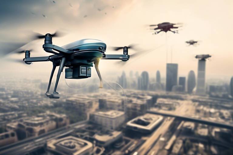
Drone Technology in Disaster Response
When it comes to disaster response, drone technology has emerged as a game-changer, offering innovative solutions that enhance our ability to respond quickly and effectively. Imagine a world where the skies are filled with drones, each one equipped with the latest technology, working tirelessly to save lives and provide assistance. These unmanned aerial vehicles (UAVs) are not just flying gadgets; they are powerful tools that can transform the landscape of disaster management.
Drones are increasingly being utilized for a variety of purposes during disasters, including surveillance, delivery of supplies, and damage assessment. For instance, in the aftermath of a natural disaster like a hurricane or earthquake, drones can quickly survey the affected areas, providing real-time data that is crucial for first responders. This capability allows emergency teams to assess the extent of the damage without putting themselves in harm's way, significantly speeding up the response time.
One of the most impressive aspects of drone technology is its ability to deliver essential supplies to hard-to-reach locations. In situations where roads are blocked or infrastructure is compromised, drones can transport food, water, medical supplies, and even communication devices directly to those in need. This not only saves time but also ensures that aid reaches victims faster, potentially saving countless lives.
Moreover, drones equipped with advanced sensors and cameras can capture high-resolution images and videos, which can then be analyzed to identify hazards and prioritize response efforts. This data can be invaluable for creating a comprehensive response plan. For example, in a wildfire scenario, drones can help identify hotspots and monitor the spread of the fire, allowing firefighters to deploy resources more effectively. The ability to gather and analyze data from the air provides a level of situational awareness that was previously unattainable.
Another fascinating application of drone technology is search and rescue operations. Drones can be deployed in areas where traditional search methods may be too dangerous or time-consuming. Equipped with thermal imaging cameras, they can detect heat signatures from missing persons, even in dense forests or rubble. This capability not only increases the chances of finding survivors but also enhances the overall efficiency of rescue operations.
As we look to the future, the potential applications of drone technology in disaster response continue to expand. With advancements in battery life, payload capacity, and autonomous flight capabilities, we can expect drones to play an even more significant role in emergency management. Collaboration between governments, tech companies, and humanitarian organizations will be essential to harness this potential effectively.
In conclusion, drone technology is revolutionizing disaster response by providing critical support in surveillance, supply delivery, damage assessment, and search and rescue operations. As these technologies evolve, they will undoubtedly enhance our ability to respond to disasters, making our communities more resilient and better prepared for the unexpected.
- What types of drones are used in disaster response?
Drones used in disaster response can vary widely, from small quadcopters for aerial photography to larger fixed-wing drones capable of carrying significant payloads for supply delivery. - How do drones improve response times during disasters?
Drones can quickly survey and assess damage, allowing first responders to gather vital information and prioritize their efforts without risking their safety. - Are there any regulations governing the use of drones in disaster response?
Yes, drone operations are subject to regulations that vary by country and region. Operators must comply with local laws, especially concerning airspace and privacy issues. - What future advancements can we expect in drone technology for disaster management?
Future advancements may include improved autonomous navigation, enhanced payload capabilities, and integration with other technologies like AI for better data analysis.

Mobile Applications for Public Safety
In today's fast-paced world, mobile applications have emerged as a game-changer in the realm of disaster preparedness and public safety. Imagine having the power of information right at your fingertips during a crisis—this is precisely what these innovative apps offer. They serve as a direct line of communication between authorities and citizens, ensuring that essential information flows seamlessly when it matters the most. With features designed to enhance situational awareness, these applications empower communities to respond more effectively to disasters. But how do they work, and what makes them so vital?
Mobile applications for public safety typically include functionalities such as real-time alerts, emergency contact information, and location-based services. For instance, during a natural disaster, these apps can send push notifications to users, informing them of evacuation routes, shelter locations, and safety tips. This immediate access to critical information can mean the difference between chaos and organized response. Furthermore, many of these applications incorporate social media elements, allowing users to share updates, report incidents, and even offer help to those in need.
One of the standout features of these apps is their ability to foster community engagement. They create a platform for citizens to connect with local authorities, enhancing collaboration in times of crisis. For example, users can submit damage reports or request assistance through the app, enabling responders to prioritize their actions based on real-time data. This two-way communication is invaluable, as it allows for a more tailored response to the unique needs of each community.
Additionally, mobile applications can include educational resources that prepare individuals for potential disasters. Users can access information on how to create emergency kits, develop family communication plans, and understand local hazards. By educating the public, these apps not only enhance preparedness but also instill a sense of confidence among citizens, making them feel more equipped to handle emergencies.
As technology continues to evolve, the future of mobile applications for public safety looks promising. Innovations such as augmented reality (AR) could revolutionize how information is presented to users, providing interactive maps that guide them to safety or help them locate nearby resources. Furthermore, integrating artificial intelligence could enhance the predictive capabilities of these apps, allowing them to deliver personalized alerts based on users' locations and preferences.
In summary, mobile applications are transforming disaster preparedness and public safety by providing timely information, fostering community engagement, and enhancing individual preparedness. As we continue to face natural disasters and emergencies, the importance of these technologies cannot be overstated. They not only save lives but also strengthen the resilience of communities, ensuring that we are better prepared for whatever challenges lie ahead.
- What are the key features of mobile applications for public safety? These apps typically include real-time alerts, emergency contact information, location-based services, and educational resources on disaster preparedness.
- How do these applications enhance community engagement? They facilitate communication between citizens and local authorities, allowing users to report incidents, request assistance, and receive timely updates.
- Can mobile applications help in real-time during a disaster? Yes, they can send push notifications with critical information, such as evacuation routes and shelter locations, ensuring users have access to essential updates.
- What is the future potential of these applications? Future innovations may include augmented reality features and AI-driven personalized alerts to enhance user experience and response capabilities.

Community Engagement Platforms
In today's fast-paced world, have emerged as a vital tool in enhancing disaster preparedness and response. These platforms serve as a bridge between authorities and citizens, facilitating real-time communication and collaboration during emergencies. Imagine a situation where a natural disaster strikes—without effective communication, chaos can ensue. However, with these platforms, communities can stay informed, share crucial information, and even mobilize resources quickly.
One of the standout features of community engagement platforms is their ability to disseminate information rapidly. For instance, during a hurricane, local authorities can use these platforms to send out alerts and updates, ensuring that everyone is aware of evacuation routes or shelter locations. This is particularly important because timely information can save lives. Moreover, these platforms often incorporate social media, allowing for a wider reach and engagement with the public.
Furthermore, community engagement platforms foster a sense of collaboration among residents. When people come together, they can share resources, skills, and knowledge. For example, a community might organize training sessions on first aid or disaster response strategies through these platforms. This not only prepares individuals but also strengthens the community as a whole. In essence, these platforms transform passive citizens into active participants in their own safety and preparedness.
Another significant advantage is the feedback mechanism that many of these platforms offer. Residents can report issues, ask questions, and provide updates on local conditions, which can be invaluable for emergency responders. By enabling two-way communication, these platforms ensure that authorities are aware of the ground realities, allowing for more effective and targeted responses. In many cases, this has led to improved resource allocation and a more coordinated response effort.
As we look to the future, the integration of emerging technologies such as artificial intelligence and machine learning into these platforms promises to enhance their capabilities even further. Imagine a platform that not only shares information but also analyzes data to predict potential disaster scenarios based on community input. This could revolutionize how communities prepare for and respond to disasters.
In summary, community engagement platforms are not just a trend; they are becoming an essential component of disaster preparedness strategies. By empowering citizens and facilitating communication, these platforms play a crucial role in building resilient communities capable of facing the challenges posed by natural disasters.
- What are community engagement platforms?
They are digital tools that facilitate communication and collaboration between authorities and citizens during emergencies. - How do these platforms improve disaster preparedness?
They provide timely information, foster collaboration, and enable feedback mechanisms for real-time updates during disasters. - Can anyone use these platforms?
Yes, they are designed for use by both authorities and community members to enhance overall safety and preparedness. - What technologies are integrated into these platforms?
Many platforms are integrating AI, machine learning, and social media to improve functionality and reach.

Emergency Alert Systems
In today's world, where natural disasters seem to be occurring more frequently and with greater intensity, having a reliable Emergency Alert System (EAS) is crucial for public safety. These systems serve as a lifeline, providing timely information to communities at risk. Imagine being alerted about an impending hurricane or an earthquake before it strikes; this can mean the difference between life and death. With advancements in technology, the effectiveness and reach of these systems have dramatically improved, allowing for faster and more efficient dissemination of critical information.
Emergency alert systems utilize a variety of channels to reach the public, including text messages, emails, and even traditional radio and television broadcasts. The integration of social media platforms has also become a game-changer, allowing authorities to share updates in real-time. For instance, when a tornado warning is issued, residents can receive alerts directly on their smartphones, ensuring they have the latest information to make informed decisions. This immediacy helps to foster a culture of preparedness, where communities are better equipped to respond to emergencies.
Moreover, the evolution of these systems has led to the development of advanced features that enhance their effectiveness. Many modern EAS include geolocation technology that allows messages to be targeted to specific areas affected by a disaster. This means that only those in the danger zone receive alerts, reducing unnecessary panic among those who are safe. Additionally, these systems can be integrated with Internet of Things (IoT) devices, such as smart home systems, which can automatically alert residents and take preventive actions, like shutting off gas lines or locking doors.
However, despite these advancements, there are still challenges that need to be addressed. One significant issue is the digital divide – not everyone has access to smartphones or the internet. This is particularly true in rural areas or among vulnerable populations. Therefore, it's essential for emergency management agencies to employ a multi-faceted approach, combining various communication methods to ensure that no one is left in the dark. Traditional methods, such as sirens and community bulletin boards, still play a vital role in reaching those who may not be digitally connected.
As we look to the future, we can expect even more innovations in emergency alert systems. With the rise of artificial intelligence and machine learning, these systems may soon be able to predict and analyze patterns in disaster occurrences, allowing for proactive alerts rather than reactive ones. Imagine a system that can send out warnings based on weather patterns and historical data, giving communities even more time to prepare and respond.
In summary, emergency alert systems are evolving rapidly, driven by technological advancements and the need for improved public safety. Their ability to provide timely, accurate, and actionable information can significantly enhance community resilience in the face of disasters. As we continue to innovate, the goal remains clear: to ensure that everyone has access to the information they need to stay safe.
- What is an Emergency Alert System?
An Emergency Alert System is a communication network designed to disseminate urgent information to the public during emergencies, such as natural disasters or public safety threats.
- How do I receive alerts from an EAS?
Alerts can be received through various channels, including text messages, emails, social media, radio, and television broadcasts.
- Are emergency alerts only sent during natural disasters?
No, emergency alerts can also be issued for other public safety threats, such as terrorist attacks or hazardous material spills.
- What should I do when I receive an emergency alert?
Follow the instructions provided in the alert, seek additional information from trusted sources, and take necessary actions to ensure your safety.

Blockchain for Disaster Relief
Blockchain technology is rapidly gaining traction as a revolutionary tool in the realm of disaster relief. Its unique features, such as decentralization, transparency, and immutability, make it an ideal candidate for enhancing the efficiency and effectiveness of disaster response efforts. Imagine a world where every donation made during a disaster can be tracked in real-time, ensuring that resources reach those who need them most without the risk of mismanagement or fraud. This is the promise that blockchain holds for disaster relief operations.
One of the most significant advantages of blockchain in disaster relief is its ability to provide transparency. Traditional relief efforts often suffer from a lack of accountability, leading to delays and misallocation of resources. With blockchain, every transaction is recorded on a public ledger that is accessible to all stakeholders, including donors, NGOs, and government agencies. This transparency fosters trust and encourages more people to contribute, knowing that their donations will be used effectively.
Moreover, blockchain can streamline resource distribution. During a disaster, the demand for aid can surge dramatically, and coordinating the logistics of delivering supplies can be a daunting task. Blockchain can facilitate this process by enabling real-time tracking of resources, ensuring that aid reaches its destination swiftly and efficiently. For instance, organizations can use smart contracts—self-executing contracts with the terms of the agreement directly written into code—to automate the distribution of funds and supplies based on pre-defined criteria.
Another area where blockchain shines is in data security and privacy. In disaster scenarios, sensitive information about affected individuals and resources is often at risk of being compromised. Blockchain's cryptographic features ensure that this data is securely stored and only accessible to authorized parties. This means that while organizations can share necessary information to coordinate relief efforts, they can also protect the privacy of those they are helping.
| Feature | Traditional Methods | Blockchain Solutions |
|---|---|---|
| Transparency | Limited visibility into fund allocation | Public ledger for real-time tracking |
| Resource Distribution | Manual coordination leading to delays | Automated logistics via smart contracts |
| Data Security | Vulnerable to breaches | Cryptographically secured data |
In conclusion, the integration of blockchain technology into disaster relief efforts is not just a trend; it is a necessity for modernizing how we respond to crises. By leveraging its capabilities, organizations can enhance their operational efficiency, increase transparency, and ultimately save more lives. As we continue to face an increasing number of natural disasters, embracing such innovative technologies is crucial for building resilient communities.
- How does blockchain improve transparency in disaster relief?
Blockchain provides a public ledger where all transactions are recorded, allowing stakeholders to track the flow of funds and resources in real-time. - Can blockchain help in resource distribution?
Yes, blockchain can automate logistics through smart contracts, ensuring that aid is distributed efficiently and without delays. - Is data security a concern in disaster relief?
Absolutely. Blockchain's cryptographic features help secure sensitive information, protecting the privacy of affected individuals while facilitating effective response.

Supply Chain Management
In the chaotic aftermath of a disaster, effective supply chain management can be the difference between life and death. Imagine a situation where aid is desperately needed, but supplies are stuck in a logistical nightmare. This is where blockchain technology steps in, revolutionizing how we manage resources during crises. By utilizing blockchain, organizations can create a transparent and tamper-proof ledger that tracks the movement of goods from the point of origin to the end user. This means that every step of the supply chain is visible, making it easier to identify bottlenecks and redirect resources as needed.
One of the most significant advantages of blockchain in supply chain management is its ability to enhance accountability. Each transaction recorded on the blockchain is immutable, meaning it cannot be altered or deleted. This feature not only helps in tracking the distribution of aid but also ensures that funds and resources are used appropriately. For example, if a donation is made for food supplies, blockchain can track exactly where those supplies go, ensuring they reach the intended recipients without being diverted.
Additionally, blockchain can streamline the procurement process. Traditional systems often involve multiple intermediaries, leading to delays and increased costs. With blockchain, organizations can directly connect with suppliers, reducing the time it takes to get essential supplies into the hands of those who need them most. This direct connection can significantly enhance the speed and efficiency of disaster response efforts.
Consider the following table, which outlines some key benefits of using blockchain in supply chain management for disaster relief:
| Benefit | Description |
|---|---|
| Transparency | Every transaction is recorded and accessible, allowing for real-time tracking of supplies. |
| Accountability | Immutable records ensure that resources are used as intended, reducing fraud and mismanagement. |
| Speed | Direct connections with suppliers minimize delays in procurement and distribution. |
| Efficiency | Streamlined processes reduce costs and enhance the overall effectiveness of relief efforts. |
Moreover, blockchain technology can significantly improve data security and privacy. In disaster situations, sensitive information about individuals and resources can be at risk. Blockchain's decentralized nature means that data is not stored in a single location, making it less vulnerable to cyberattacks. This aspect is crucial in maintaining the integrity of disaster response efforts, ensuring that personal data and logistical details are kept secure.
In conclusion, as we look towards the future of disaster preparedness, integrating blockchain into supply chain management is not just an option—it's a necessity. The ability to track resources transparently, ensure accountability, and enhance efficiency can dramatically improve the effectiveness of disaster response initiatives. By embracing these technological advancements, we are taking a significant step towards building resilient communities that can withstand and recover from the impacts of natural disasters.
- What is blockchain technology? Blockchain technology is a decentralized digital ledger that records transactions across many computers, ensuring that the recorded transactions cannot be altered retroactively.
- How does blockchain improve supply chain management? Blockchain improves supply chain management by providing transparency, accountability, and efficiency in tracking the movement of goods and resources.
- Can blockchain protect sensitive information? Yes, blockchain can enhance data security by decentralizing data storage, making it less susceptible to breaches.
- What are the challenges of implementing blockchain in disaster relief? Challenges include the need for technology infrastructure, training personnel, and ensuring that all stakeholders are on board with the new system.

Data Security and Privacy
In the realm of disaster preparedness, data security and privacy are not just buzzwords; they are essential components that can determine the effectiveness of response efforts. As we increasingly rely on technology to manage disaster scenarios, the amount of sensitive information being collected and processed has skyrocketed. This includes everything from personal identification details of affected individuals to critical data about resources and supplies. So, how can we ensure that this data is not only protected but also used efficiently to save lives?
One of the most promising solutions lies in blockchain technology. By its very design, blockchain offers a decentralized and secure way to store data, making it incredibly difficult for unauthorized parties to tamper with or access sensitive information. Imagine a ledger that is not only transparent but also immutable—once data is entered, it cannot be altered without consensus from all parties involved. This feature is particularly crucial in disaster scenarios where trust and accountability are paramount.
Furthermore, blockchain can enhance privacy by allowing individuals to control their own data. Instead of centralizing sensitive information in vulnerable databases, blockchain enables users to share only the necessary details with authorized entities. This means that in the event of a disaster, affected individuals can provide their information for aid without exposing their entire personal history. It's a bit like having a digital lockbox where you can choose what to share and with whom.
However, while blockchain offers exciting possibilities, it is not without challenges. For instance, the technology is still relatively new, and many organizations may lack the expertise to implement it effectively. Additionally, there are concerns about the energy consumption of blockchain networks, which could be a drawback in disaster-stricken areas where resources are already limited.
To address these challenges, stakeholders must prioritize education and training in blockchain technology. Governments and organizations should invest in building capacities that allow for a seamless integration of this technology into existing disaster management frameworks. This investment could lead to a future where data security and privacy are not just afterthoughts, but integral parts of disaster preparedness strategies.
In conclusion, as we continue to innovate and adapt our disaster management practices, ensuring data security and privacy must remain at the forefront. By leveraging technologies like blockchain, we can not only protect sensitive information but also enhance the overall effectiveness of our disaster response efforts. After all, when disaster strikes, the last thing we want to worry about is whether our data is safe.
- What is blockchain technology? Blockchain is a decentralized digital ledger that securely records transactions across many computers, making it nearly impossible to alter or hack.
- How can blockchain enhance data security in disaster preparedness? By decentralizing data storage and providing users with control over their information, blockchain minimizes the risk of unauthorized access and data breaches.
- Are there any downsides to using blockchain for disaster management? Yes, challenges include the need for technical expertise and concerns about energy consumption in blockchain networks.
Frequently Asked Questions
-
What role does Artificial Intelligence play in disaster preparedness?
Artificial Intelligence (AI) is a game-changer in disaster preparedness. It helps in predictive analytics, which means it can analyze data to anticipate disasters before they happen. AI enhances decision-making by providing real-time insights and automates response strategies, making it easier for authorities to act swiftly when a disaster strikes.
-
How do IoT and smart sensors improve disaster response?
The Internet of Things (IoT) and smart sensors are vital for real-time monitoring. They collect data that helps in understanding the current situation during a disaster. For instance, sensors can detect changes in environmental conditions, alerting responders to potential hazards, thus improving situational awareness and ensuring timely interventions.
-
What are remote sensing technologies, and how do they assist in disaster management?
Remote sensing technologies, like satellite imagery and aerial surveys, provide critical data for assessing disaster risks. They help in visualizing affected areas, which is essential for planning effective response strategies and resource allocation during emergencies.
-
Why are satellite communication systems important during disasters?
Satellite communication systems are crucial because they maintain connectivity when traditional networks fail. This ensures that responders can communicate effectively with each other and with affected communities, which is vital for coordinating relief efforts and disseminating information.
-
How do mobile applications enhance public safety in disaster situations?
Mobile applications have revolutionized how communities prepare for and respond to disasters. They provide essential features like emergency alerts, safety tips, and real-time updates. These apps empower individuals with information, enabling them to make informed decisions during crises.
-
What is the significance of community engagement platforms during disasters?
Community engagement platforms facilitate communication between authorities and citizens, fostering collaboration during disasters. They allow for the sharing of critical information and resources, ensuring that everyone is informed and can work together effectively in times of need.
-
How can blockchain technology improve disaster relief efforts?
Blockchain technology enhances transparency and efficiency in disaster relief by streamlining resource distribution. It ensures that aid reaches those in need by tracking resources and donations, which helps in minimizing fraud and maximizing accountability.
-
What role does blockchain play in supply chain management during disasters?
Blockchain optimizes supply chain management by providing a secure and transparent way to track resources. This ensures that aid is delivered efficiently and effectively, making it easier to manage logistics and respond to the needs of affected communities.
-
How does blockchain ensure data security and privacy in disaster preparedness?
Blockchain technology enhances data security and privacy by encrypting sensitive information. This means that while it facilitates effective disaster response, it also protects personal data from unauthorized access, ensuring that individuals' privacy is respected during emergencies.