How Tech is Revolutionizing Disaster Relief Efforts
In a world where natural disasters can strike at any moment, the need for efficient and effective disaster relief has never been more critical. Enter technology—a game changer that is transforming the way we respond to emergencies. From devastating earthquakes to catastrophic floods, the integration of innovative technologies is not just a luxury but a necessity in humanitarian efforts. Imagine drones soaring through the sky, delivering life-saving supplies, or artificial intelligence predicting the next big storm before it hits. This is not science fiction; it's the reality of modern disaster relief. In this article, we will explore how advancements in communication, logistics, and data analysis are enhancing the efficiency and effectiveness of humanitarian efforts, ultimately saving lives and resources.
The landscape of disaster relief is rapidly changing, thanks to the emergence of cutting-edge technologies. Drones and artificial intelligence (AI) are at the forefront of this revolution, making operations faster and more efficient. For instance, drones can quickly survey disaster-stricken areas, offering a bird's-eye view that was once only possible through expensive aerial photography. AI, on the other hand, analyzes vast amounts of data in seconds, allowing responders to make informed decisions based on real-time information. These technologies are not just tools; they are lifelines that connect those in need with the help they require.
Drones have become invaluable assets in disaster relief efforts. Their ability to provide aerial views, deliver supplies, and assist in search and rescue operations has revolutionized how we respond to emergencies. Picture this: a remote village cut off from the outside world due to a landslide. Traditional methods of delivering aid could take days, but with drones, essential supplies can reach those in need within hours. This capability not only saves lives but also optimizes the use of resources during critical situations.
One of the standout features of drones is their advanced mapping technology. Equipped with high-resolution cameras and sensors, drones can quickly assess damage and identify areas in need of immediate assistance. This allows relief organizations to direct their efforts where they are most required, ensuring that no one is left behind. For example, after a hurricane, drones can map out flooded regions, providing vital information that helps responders prioritize their actions.
The ability of drones to collect real-time data is a game changer. Imagine being able to monitor the aftermath of a disaster as it unfolds, allowing responders to adapt their strategies on the fly. This real-time insight helps organizations optimize resource allocation, ensuring that aid reaches those who need it most when they need it. The speed and accuracy of data collection from drones can significantly enhance the effectiveness of disaster response efforts.
Drones are not just for surveying; they can also transport critical supplies. Whether it's medical equipment, food, or water, drones can deliver these essentials to remote or inaccessible areas. This capability ensures that affected populations receive timely aid, which can be the difference between life and death in emergencies. The ability to bypass traditional transportation routes can drastically improve the speed of relief efforts.
Artificial intelligence and machine learning are revolutionizing data analysis in disaster management. These technologies can predict disasters and optimize response strategies by analyzing vast amounts of information quickly. For instance, AI can analyze weather patterns and historical data to forecast potential disasters, allowing organizations to prepare in advance. This proactive approach can save lives and resources by enabling timely evacuations and resource mobilization.
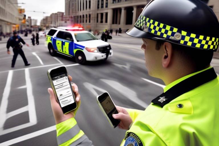
In the chaos of a disaster, communication is key. Mobile communication technologies play a crucial role in disaster relief, enabling coordination among responders and ensuring that affected communities remain connected. Imagine being in a disaster zone where traditional communication networks are down. This is where mobile apps and satellite communication systems come into play, providing a lifeline for both rescue teams and affected individuals.
Satellite communication systems offer reliable connectivity in disaster-stricken areas where traditional networks may be down. This technology facilitates communication for rescue teams, allowing them to share vital information and coordinate their efforts effectively. In addition, it enables affected individuals to reach out for help, ensuring that no one is left isolated during emergencies.
Innovative mobile applications are being developed to streamline disaster response. These apps allow users to report incidents, request aid, and receive updates, enhancing community engagement and support. Imagine a community where everyone is connected through a single app, sharing information and resources during a crisis. This level of connectivity can significantly improve the efficiency of disaster response efforts.
Data analytics is transforming disaster management by providing insights into patterns and trends. By analyzing historical data and using predictive modeling, organizations can develop better preparedness and response strategies. This analytical approach allows responders to anticipate disaster impacts and make informed decisions that can save lives.
Predictive modeling helps organizations simulate various disaster scenarios, allowing them to anticipate impacts and develop effective response plans tailored to specific situations. This proactive approach can significantly enhance the efficiency of disaster management efforts, ensuring that responders are well-prepared for any eventuality.
Geospatial analysis tools help responders visualize affected areas, optimize resource distribution, and ensure that aid reaches those who need it most efficiently. By mapping out affected regions, organizations can allocate resources strategically, maximizing the impact of their efforts. This level of precision is critical in ensuring that aid is delivered where it is most needed.
- How do drones improve disaster response?
Drones provide aerial views, deliver supplies, and assist in search and rescue operations, which enhances the speed and efficiency of relief efforts. - What role does AI play in disaster management?
AI analyzes vast amounts of data quickly, helping predict disasters and optimize response strategies. - Why is mobile communication important during disasters?
It enables coordination among responders and keeps affected communities connected, ensuring timely assistance. - How does data analytics enhance disaster preparedness?
Data analytics provides insights into patterns and trends, allowing organizations to develop better preparedness and response strategies.

Emerging Technologies in Disaster Relief
In the face of natural disasters, the **need for swift and effective response** has never been more critical. As we navigate the complexities of humanitarian efforts, **emerging technologies** are stepping up to the plate, transforming the way we prepare for, respond to, and recover from disasters. From the skies above to the data-driven decisions made on the ground, these innovations are not just tools; they are lifelines that can mean the difference between life and death.
One of the most exciting advancements is the use of **drones**. These nimble flying machines are not just for taking stunning aerial photographs; they are equipped with sophisticated technology that allows them to perform vital functions during crises. Imagine a drone soaring over a disaster zone, capturing high-resolution images that reveal the extent of the damage. This capability enables responders to quickly assess the situation, identify hotspots, and prioritize their efforts where they are most needed.
But drones are more than just eyes in the sky. They also play a crucial role in logistics. For instance, in remote areas where roads may be blocked or infrastructure damaged, drones can deliver essential supplies such as food, water, and medical aid. This rapid delivery can significantly **reduce the time it takes for aid to reach those in desperate need**, making a tangible difference in the survival and recovery of affected populations.
Alongside drones, **artificial intelligence (AI)** and **machine learning** are revolutionizing the way we analyze data in disaster management. These technologies can sift through vast amounts of information at lightning speed, identifying patterns and predicting potential disaster scenarios. For example, AI can analyze weather data, seismic activity, and historical disaster information to forecast future events, allowing organizations to prepare more effectively. This predictive capability not only enhances response strategies but also fosters a proactive approach to disaster management.
Moreover, mobile communication technologies are also emerging as game-changers in disaster relief. When traditional communication networks fail, **satellite communication systems** provide a reliable alternative, ensuring that rescue teams can coordinate efforts seamlessly. Additionally, innovative mobile apps are being developed to facilitate crisis management. These applications empower users to report incidents, request aid, and receive real-time updates, fostering a sense of community and support during chaotic times.
In summary, the **integration of emerging technologies** in disaster relief efforts is not just a trend; it’s a **revolution** that enhances our ability to respond effectively. As we embrace these innovations, we pave the way for a future where disaster response is not only faster but also smarter, ultimately saving more lives and restoring communities more efficiently.

The Role of Drones in Disaster Response
Drones have emerged as a game-changer in the realm of disaster response, bringing a level of efficiency and effectiveness that was previously unimaginable. Imagine being able to send a flying robot to assess damage in a disaster-stricken area, all while keeping human responders safe and sound. This is not science fiction; it's the reality we live in today. Drones are equipped with advanced technology that allows them to provide aerial views, deliver essential supplies, and assist in search and rescue operations. Their ability to operate in challenging environments makes them invaluable during emergencies, ultimately saving lives and conserving resources.
One of the standout features of drones is their mapping and surveillance capabilities. Equipped with high-resolution cameras and advanced sensors, drones can quickly assess damage across vast areas. This capability is crucial when every second counts, as it ensures that relief efforts are directed where they are most needed. Imagine a drone flying over a devastated landscape, capturing real-time images that help responders identify the hardest-hit areas. This visual intelligence allows for a more targeted response, ensuring that resources are allocated effectively and efficiently.
Another remarkable aspect of drones is their ability to collect real-time data. In the chaos of a disaster, having accurate information is vital for making informed decisions. Drones can gather data on weather conditions, structural damages, and even the movement of affected populations. This information can be transmitted back to command centers almost instantly, allowing responders to adapt their strategies on the fly. The agility provided by drones in this context is akin to having a bird’s-eye view of the situation, enabling a swift and effective response.
Perhaps one of the most compelling uses of drones in disaster relief is their capacity to deliver essential supplies. When roads are blocked, or access is restricted, drones can swoop in to transport medical supplies, food, and water to remote or inaccessible areas. This capability is not just about speed; it's about ensuring that affected populations receive the aid they need promptly. For instance, in the aftermath of a natural disaster, a drone can deliver life-saving medications to a community cut off from traditional supply routes. This kind of rapid response can make a significant difference in survival rates and recovery times.
As if their physical capabilities weren't impressive enough, drones are also being enhanced with artificial intelligence (AI) and machine learning technologies. These advancements allow drones to analyze the data they collect in real-time, improving the decision-making process. For example, AI algorithms can help identify which areas need the most urgent attention based on the damage assessed by the drone. The integration of AI into drone technology is akin to giving these flying machines a brain, enabling them to learn and adapt to different situations, making them even more effective in disaster response scenarios.
In summary, the role of drones in disaster response is nothing short of revolutionary. Their mapping capabilities, real-time data collection, and delivery of essential supplies are transforming how humanitarian efforts are conducted. As technology continues to evolve, we can expect drones to become an even more integral part of disaster response strategies, ensuring that help reaches those in need faster and more efficiently than ever before.
- How do drones help in disaster response? Drones provide aerial views, deliver supplies, and collect real-time data, enhancing the efficiency of disaster relief efforts.
- What kind of supplies can drones deliver? Drones can transport medical supplies, food, water, and other essential items to remote or inaccessible areas.
- Can drones operate in bad weather? While drones have limitations in severe weather conditions, many are designed to withstand moderate rain and winds.
- How is AI used in drones for disaster management? AI helps drones analyze collected data, improving decision-making and optimizing response strategies.

Mapping and Surveillance Capabilities
In the chaotic aftermath of a disaster, having a clear view of the affected areas is crucial. This is where drones step in, equipped with advanced mapping technology that provides real-time surveillance capabilities. Imagine a bird’s-eye view of a city that has just been struck by a hurricane; the ability to assess damage from above can drastically change the game for rescue teams. Drones can fly over vast areas in a fraction of the time it would take ground teams, capturing high-resolution images and generating detailed maps that highlight the most severely impacted zones.
These aerial views are not just pretty pictures; they serve a vital purpose. By utilizing geospatial data, responders can identify where to direct their efforts. For instance, if a drone reveals that a particular neighborhood is completely flooded while another is relatively dry, aid can be prioritized accordingly. This targeted approach ensures that resources are allocated efficiently, maximizing the impact of every relief effort.
Furthermore, drones can be outfitted with various sensors that can detect heat signatures, which is particularly useful in search and rescue operations. When a building collapses, for example, the ability to locate survivors trapped beneath rubble is invaluable. The technology enables responders to visualize the situation in real-time, allowing them to make quick, informed decisions about where to concentrate their search efforts.
To illustrate the effectiveness of drones in mapping and surveillance, consider the following table that outlines some key features:
| Feature | Description |
|---|---|
| High-Resolution Imaging | Provides detailed visuals of affected areas, enabling accurate damage assessment. |
| Real-Time Data Transmission | Allows for immediate sharing of information with rescue teams on the ground. |
| Thermal Imaging | Helps locate heat signatures from survivors, even in low visibility conditions. |
| Mapping Software Integration | Facilitates the creation of detailed maps that outline areas in need of assistance. |
In conclusion, the mapping and surveillance capabilities of drones are revolutionizing disaster response. They provide a crucial advantage in the race against time, ensuring that help reaches those who need it most. By harnessing this technology, humanitarian efforts can become more efficient, effective, and ultimately, more lifesaving.
- How do drones improve disaster response?
Drones provide aerial views and real-time data, allowing responders to assess damage quickly and allocate resources effectively. - What kind of data can drones collect?
Drones can collect high-resolution images, thermal data, and geospatial information to assist in mapping affected areas. - Are drones safe to use during disasters?
Yes, when operated by trained professionals, drones can safely navigate disaster zones and provide valuable insights without putting additional lives at risk. - Can drones deliver supplies?
Absolutely! Drones are increasingly being used to transport essential supplies to remote or hard-to-reach areas during emergencies.

Real-Time Data Collection
In today's fast-paced world, has emerged as a game-changer in disaster response efforts. Imagine a scenario where a natural disaster strikes—every second counts, and the ability to gather and analyze data instantly can mean the difference between life and death. Drones equipped with advanced sensors and imaging technology are at the forefront of this revolution, providing critical situational awareness to responders on the ground.
These drones can fly over affected areas, capturing high-resolution images and videos that allow teams to assess damage rapidly. This is not just about seeing the destruction; it's about understanding the severity and scope of the disaster in real time. For instance, the use of infrared cameras can help identify heat signatures, which is invaluable in search and rescue operations, especially when locating trapped individuals.
Moreover, the data collected by these drones can be processed and analyzed using sophisticated algorithms, providing actionable insights almost immediately. Responders can prioritize their efforts based on the most affected regions, ensuring that resources are allocated where they are needed the most. This data-driven approach enhances the efficiency of relief operations, allowing teams to make informed decisions quickly.
To illustrate the impact of real-time data collection, consider the following table that outlines the benefits:
| Benefit | Description |
|---|---|
| Rapid Assessment | Quickly evaluates the extent of damage, enabling faster response times. |
| Resource Optimization | Helps in directing resources to areas with the highest need. |
| Enhanced Coordination | Facilitates better communication and coordination among rescue teams. |
| Real-Time Monitoring | Allows continuous monitoring of evolving situations, adapting strategies as needed. |
In addition to drones, other technologies like mobile apps and cloud computing are also playing a significant role in real-time data collection. For example, mobile applications allow citizens to report incidents and share information with authorities instantly. This grassroots level of data collection enriches the overall picture of the disaster, ensuring that no critical information is overlooked.
Ultimately, the integration of real-time data collection into disaster response efforts is a powerful tool that enhances operational effectiveness. It empowers responders with the knowledge they need to act swiftly and decisively, ultimately saving lives and minimizing the impact of disasters on communities. As technology continues to advance, we can expect even more innovative solutions to emerge, further revolutionizing the way we respond to crises.
- What types of data can drones collect during a disaster? Drones can collect visual data (images and videos), thermal data (heat signatures), and geographical data (topographical maps) to assess damage and locate survivors.
- How does real-time data collection improve disaster response? It allows responders to make informed decisions quickly, optimizes resource allocation, and enhances coordination among various teams.
- Are there any limitations to using drones for data collection? Yes, factors like weather conditions, battery life, and regulatory restrictions can affect drone operations.

Delivery of Essential Supplies
In the face of natural disasters, the timely delivery of essential supplies can mean the difference between life and death. This is where drones shine, acting as the unsung heroes of disaster relief. Imagine a scenario where a devastating earthquake strikes a remote village, cutting off all traditional means of transportation. Roads are blocked, and the local infrastructure is in shambles. In such dire circumstances, drones equipped with the capability to transport medical supplies, food, and water become a lifeline for those in need.
Drones can swiftly navigate to areas that are otherwise inaccessible, delivering critical supplies that may take days or even weeks to reach via conventional methods. They can cover vast distances in a fraction of the time, ensuring that aid reaches those who need it most. For instance, a drone can carry a payload of up to 5 kg, which might include:
- Medical kits for first aid and emergency care
- Non-perishable food items
- Bottled water and hydration supplies
Moreover, the use of drones in delivering these supplies is not just about speed; it's also about precision. Advanced GPS technology ensures that drones can pinpoint exact locations, allowing them to drop supplies directly into the hands of those who are stranded or in urgent need. This level of accuracy minimizes waste and maximizes the impact of every delivery.
Additionally, drones can be equipped with thermal imaging and high-resolution cameras, allowing them to survey affected areas and identify where supplies are most needed. This real-time data collection complements the delivery process, enabling responders to adjust their strategies on the fly. By analyzing the situation from above, they can determine if a particular area is still cut off or if it has become accessible, thus optimizing the delivery routes for future missions.
As we look to the future of disaster relief, the integration of drones into logistics operations is becoming increasingly sophisticated. Companies and organizations are continually developing new technologies and methods to enhance drone capabilities. For example, some are experimenting with swarm technology, where multiple drones can work together to cover larger areas and deliver supplies more effectively. This innovation could revolutionize how we think about disaster response, making it faster, more efficient, and ultimately saving more lives.
Q: How do drones ensure the safe delivery of supplies in disaster zones?
A: Drones utilize GPS technology for pinpoint accuracy and can be equipped with sensors to avoid obstacles, ensuring safe delivery even in challenging environments.
Q: What types of supplies can drones deliver?
A: Drones can transport various supplies, including medical kits, food, water, and even communication devices, depending on their payload capacity.
Q: Are there regulations governing the use of drones in disaster relief?
A: Yes, there are regulations that vary by country, ensuring that drone operations are conducted safely and responsibly, particularly in populated areas.
Q: How can drones be deployed in areas with damaged infrastructure?
A: Drones can fly over obstacles and reach isolated locations without relying on ground transportation, making them ideal for areas with damaged roads or bridges.

AI and Machine Learning Applications
Artificial Intelligence (AI) and machine learning are not just buzzwords; they are transformative forces reshaping disaster management. Imagine having the ability to predict a natural disaster before it strikes, or to optimize the allocation of resources in real-time based on data analysis. This is precisely what AI and machine learning bring to the table. By analyzing vast amounts of data quickly, these technologies enable responders to make informed decisions that can save lives and resources.
One of the most exciting applications of AI in disaster relief is its predictive capabilities. By leveraging historical data and real-time information, AI algorithms can forecast potential disasters, such as floods or earthquakes, with remarkable accuracy. This predictive modeling allows organizations to prepare more effectively, ensuring that they have the necessary resources and strategies in place before disaster strikes. For example, AI can analyze weather patterns, seismic activity, and even social media trends to identify potential threats, giving communities a crucial heads-up.
Moreover, machine learning algorithms can continuously improve their predictions by learning from past events. This creates a feedback loop where the more data they process, the better they become at predicting future disasters. Think of it as teaching a child to recognize patterns; the more they practice, the more adept they become. This capability is vital for disaster response organizations, as it allows them to adapt and refine their strategies over time.
In addition to predictive analytics, AI and machine learning also play a significant role in optimizing resource allocation during emergencies. For instance, when a disaster occurs, responders must quickly assess the situation and determine where aid is most needed. AI systems can analyze data from various sources, including social media, satellite imagery, and on-the-ground reports, to create a comprehensive picture of the affected areas. This enables organizations to deploy resources more efficiently, ensuring that help reaches those in dire need without unnecessary delays.
To illustrate this point, consider the following table that highlights the key applications of AI and machine learning in disaster management:
| Application | Description |
|---|---|
| Predictive Analytics | Forecasting potential disasters using historical and real-time data. |
| Resource Optimization | Analyzing data to allocate resources effectively during emergencies. |
| Damage Assessment | Using AI to analyze satellite images and assess damage levels. |
| Communication Enhancement | Improving coordination among responders through data integration. |
Ultimately, the integration of AI and machine learning into disaster management is not just about technology; it's about enhancing human capabilities and improving outcomes in critical situations. By harnessing these tools, responders can act swiftly and intelligently, ensuring that they are always one step ahead in their efforts to save lives and restore communities. As we continue to innovate and refine these technologies, the future of disaster relief looks not only promising but also profoundly impactful.
- How does AI predict disasters? AI analyzes historical data, weather patterns, and real-time information to forecast potential disasters.
- What role does machine learning play in resource allocation? Machine learning algorithms process vast amounts of data to optimize the distribution of resources during emergencies.
- Can drones work with AI in disaster relief? Absolutely! Drones equipped with AI can assess damage and deliver supplies based on real-time data analysis.

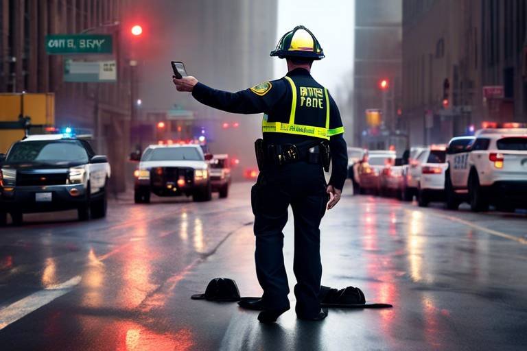
Mobile Communication Technologies
In the realm of disaster relief, are nothing short of a lifeline. When disaster strikes, traditional communication infrastructures often crumble, leaving communities isolated and responders in the dark. However, with the advent of modern mobile solutions, we are witnessing a significant transformation in how help is coordinated and delivered. Imagine being able to send a distress signal or request aid with just a few taps on your smartphone, even when the world around you is chaotic. This is the power of mobile technology in action.
One of the most remarkable advancements in this area is the development of satellite communication systems. These systems are designed to function even when local networks fail, providing a reliable means of communication for both rescue teams and affected individuals. They act as a bridge, connecting those in need with the help they require. By utilizing satellite technology, responders can maintain constant communication, share updates, and coordinate efforts seamlessly. This is crucial in ensuring that aid reaches the right people at the right time.
Furthermore, innovative mobile applications are emerging as game-changers in crisis management. These apps empower users to report incidents, request assistance, and receive real-time updates about the situation in their area. For instance, applications like Disaster Alert and FEMA App provide users with essential information, including safety tips and emergency contacts. The interactive nature of these apps not only enhances community engagement but also fosters a sense of solidarity among individuals during tough times.
Consider the following benefits of mobile communication technologies in disaster relief:
- Enhanced Coordination: Mobile tech allows for quick and efficient communication between various agencies and responders, ensuring everyone is on the same page.
- Immediate Updates: Affected individuals can receive timely alerts about evacuation routes, shelter locations, and safety protocols.
- Data Collection: Mobile apps can gather data on the ground, providing valuable insights into the needs of affected communities.
Moreover, the integration of social media platforms into disaster response strategies cannot be overlooked. These platforms serve as powerful tools for information dissemination and community mobilization. During emergencies, social media can be utilized to broadcast urgent messages, share resources, and connect volunteers with those in need. The viral nature of social media ensures that critical information spreads rapidly, reaching a wider audience than traditional methods ever could.
In conclusion, mobile communication technologies are revolutionizing disaster relief efforts by enhancing connectivity, improving coordination, and fostering community engagement. As we continue to innovate and adapt, these technologies will play an increasingly vital role in ensuring that help reaches those who need it most, transforming chaos into a more organized and effective response.
Q: How do mobile communication technologies help during a disaster?
A: They provide reliable communication channels, enabling coordination among responders and ensuring that affected communities can request aid and receive updates.
Q: What role do satellite communication systems play?
A: They offer connectivity in areas where traditional networks are down, allowing rescue teams and individuals to communicate effectively.
Q: Are there specific apps designed for disaster management?
A: Yes, there are several mobile applications like Disaster Alert and FEMA App that help users report incidents, request assistance, and receive important updates.

Satellite Communication Systems
In the chaotic aftermath of a disaster, maintaining communication can be as crucial as providing food and shelter. This is where step in as a lifeline. Unlike traditional communication networks, which can be easily disrupted by natural calamities, satellite systems operate independently of terrestrial infrastructure. This means that even when the ground is in disarray, these systems can provide a reliable means of communication for both rescue teams and affected individuals.
Imagine a scenario where a devastating earthquake strikes a remote region. Roads are blocked, power lines are down, and local cell towers are rendered useless. In such a situation, satellite communication systems can bridge the gap. They allow for real-time communication between rescue teams and command centers, ensuring that vital information flows smoothly. This capability can significantly enhance the coordination of relief efforts, making it possible to direct resources where they are needed most.
Moreover, these systems are not just limited to voice communication. They can transmit data, images, and even video, providing a comprehensive overview of the situation on the ground. For instance, a rescue team can send back live footage of a disaster site, allowing experts to assess the damage and deploy resources accordingly. This kind of visual data is invaluable for making informed decisions quickly, especially when every second counts.
In addition to aiding rescue teams, satellite communication systems also empower affected communities. People can use satellite phones or internet connections to reach out to loved ones, report their status, or request help. This connectivity can provide a sense of normalcy and hope in times of crisis, reminding individuals that they are not alone in their struggle.
To illustrate the impact of satellite communication systems, consider the following table that compares traditional communication methods with satellite systems during disaster scenarios:
| Feature | Traditional Communication | Satellite Communication |
|---|---|---|
| Reliability | Highly susceptible to damage | Operates independently of local infrastructure |
| Data Transmission | Limited to voice, often interrupted | Supports voice, data, images, and video |
| Accessibility | Depends on local networks | Available in remote and isolated areas |
| Speed of Deployment | Can be delayed due to infrastructure damage | Quickly deployable, often requiring minimal setup |
In summary, satellite communication systems are a game-changer in disaster relief efforts. They not only enhance the efficiency of rescue operations but also provide emotional support to affected individuals by keeping them connected. In a world where disasters can strike at any moment, having such robust communication capabilities is not just an advantage; it’s a necessity.
- How do satellite communication systems work? Satellite communication systems transmit signals to and from satellites orbiting the Earth, allowing for communication in areas where traditional networks may be down.
- Are satellite phones expensive to use? While the initial cost of satellite phones can be high, the ability to communicate in crisis situations can be invaluable, making them worth the investment for many organizations.
- Can satellite communication systems be used for non-emergency situations? Yes, these systems are also used for various applications, including remote work, travel, and exploration in areas lacking infrastructure.

Mobile Apps for Crisis Management
In today's fast-paced world, the advent of mobile apps has significantly transformed the way we approach crisis management. These applications are not just tools; they are lifelines that connect communities, responders, and resources in real time. Imagine being in the midst of a disaster, with chaos all around, and having the power of information at your fingertips. That's the magic of mobile technology in crisis situations.
Mobile apps designed for crisis management serve multiple purposes. They allow individuals to report incidents, request aid, and receive timely updates about the situation on the ground. For instance, during natural disasters, these apps can provide critical information about evacuation routes, shelter locations, and safety tips. By facilitating communication between affected individuals and response teams, these applications help ensure that no one is left behind.
One of the standout features of these apps is their ability to enhance community engagement. Users can share their experiences, post updates, and even volunteer their services, creating a network of support that can be invaluable during emergencies. This sense of community not only boosts morale but also fosters a collaborative spirit among those affected and those providing aid.
Moreover, many of these mobile applications incorporate real-time mapping and geolocation features, allowing responders to visualize the disaster's impact and prioritize their actions. For example, an app might show areas where people are trapped or in need of immediate assistance, enabling responders to allocate resources more effectively. This is where technology meets humanity, ensuring that help reaches those who need it the most.
To illustrate the power of mobile apps in crisis management, consider the following table that highlights some popular applications currently in use:
| App Name | Key Features | Target Audience |
|---|---|---|
| Disaster Alert | Real-time alerts, safety tips, community sharing | General public |
| Red Cross Emergency | First aid information, disaster preparedness guides | Individuals and families |
| FEMA App | Disaster resources, emergency kit checklist | U.S. residents |
| Life360 | Location sharing, emergency alerts | Families and friends |
As we continue to innovate and improve these applications, the potential for enhancing disaster response becomes even greater. Ultimately, the integration of mobile technology into crisis management not only streamlines operations but also empowers individuals to take charge of their safety and well-being. In a world where disasters can strike at any moment, having the right tools at our disposal can make all the difference.
- What types of mobile apps are available for crisis management?
There are various mobile apps designed for crisis management, including those for reporting incidents, providing real-time updates, and offering safety information. Examples include the Red Cross Emergency app and FEMA App.
- How do mobile apps enhance communication during disasters?
Mobile apps facilitate communication by allowing users to share information, request assistance, and receive alerts, ensuring that both responders and affected individuals stay connected.
- Can mobile apps help in resource allocation during emergencies?
Yes, many mobile apps include mapping and geolocation features that help responders visualize affected areas and prioritize resource distribution effectively.

Data Analytics in Disaster Management
In the fast-paced world of disaster management, data analytics has emerged as a game-changer. It enables organizations to sift through vast amounts of information quickly and efficiently, transforming raw data into actionable insights. This capability is crucial when every second counts, especially in the wake of natural disasters where timely intervention can mean the difference between life and death. By leveraging historical data and predictive modeling, responders can not only prepare for imminent threats but also refine their strategies for future disasters.
One of the most powerful aspects of data analytics is its ability to identify patterns and trends that might not be immediately visible. For instance, through geospatial analysis, responders can visualize areas that are most vulnerable to specific types of disasters. This allows for a more targeted approach in resource allocation. Imagine a map highlighting high-risk zones for flooding or earthquakes; this visual representation helps teams strategize their efforts effectively. With tools that integrate real-time data, responders can adjust their plans dynamically, ensuring that they are always a step ahead.
Moreover, predictive modeling and simulation play integral roles in enhancing preparedness. These techniques allow organizations to simulate various disaster scenarios based on historical data, helping them understand potential impacts and develop tailored response plans. For example, a simulation might reveal that certain neighborhoods are more susceptible to flooding during heavy rains, prompting preemptive measures like sandbagging or evacuation plans. This proactive approach not only saves lives but also minimizes property damage, making it a win-win for communities.
To illustrate the significance of data analytics in disaster management, consider the following table that summarizes key components:
| Component | Description | Benefits |
|---|---|---|
| Predictive Modeling | Analyzing historical data to forecast future disasters. | Improved preparedness and strategic response planning. |
| Geospatial Analysis | Mapping vulnerable areas and resource distribution. | Efficient allocation of aid and resources. |
| Real-Time Data Integration | Incorporating live data feeds for immediate analysis. | Quick decision-making and responsive actions during crises. |
In conclusion, the integration of data analytics in disaster management is not just a trend; it’s a necessity. As technology continues to evolve, so too will the methods we employ to protect our communities. By harnessing the power of data, we can enhance our preparedness, response, and recovery efforts, ultimately leading to more resilient societies. So, the next time disaster strikes, remember that behind the scenes, data analytics is working tirelessly to ensure that help arrives swiftly and effectively.
- What is data analytics in disaster management? Data analytics in disaster management involves using data to analyze, predict, and respond to disasters effectively.
- How does predictive modeling help in disaster management? Predictive modeling helps anticipate disaster impacts, allowing organizations to create effective response plans.
- Why is geospatial analysis important? Geospatial analysis helps visualize affected areas, optimizing resource distribution and ensuring aid reaches those in need.
- Can data analytics improve community resilience? Yes, by enhancing preparedness and response strategies, data analytics plays a crucial role in building resilient communities.

Predictive Modeling and Simulation
In the realm of disaster management, have emerged as game-changers, allowing organizations to anticipate and prepare for various disaster scenarios. Imagine being able to forecast the impact of a hurricane or an earthquake before it even strikes. This capability not only enhances preparedness but also significantly improves response strategies, ultimately saving lives and resources. By utilizing historical data, weather patterns, and geographical information, predictive models can simulate potential disasters and their effects on communities.
These models operate on the principle of data-driven decision-making. For instance, when a natural disaster is predicted, agencies can run simulations to see how different factors—like population density, infrastructure resilience, and available resources—could influence the outcome. This allows them to tailor their response plans effectively. The beauty of predictive modeling lies in its ability to provide insights that are not just theoretical but grounded in actual data, making them invaluable for emergency planners.
To illustrate the power of predictive modeling, consider the following table that outlines key elements involved in the simulation process:
| Element | Description |
|---|---|
| Data Collection | Gathering historical data, weather forecasts, and demographic information. |
| Model Development | Creating mathematical models that represent potential disaster scenarios. |
| Simulation | Running scenarios to visualize the impact of disasters on communities. |
| Analysis | Interpreting the results to inform response strategies and resource allocation. |
Moreover, these simulations can be used to conduct what-if analyses. For example, what if a disaster strikes during peak tourist season? Or what if emergency services are overwhelmed? By exploring these scenarios, disaster response teams can devise contingency plans that prepare them for the unexpected.
Another crucial aspect of predictive modeling is its ability to facilitate collaboration among different stakeholders. When various organizations—such as government agencies, NGOs, and local communities—share data and insights, they can create a more comprehensive response plan. This collaborative approach ensures that everyone is on the same page and can act swiftly when disaster strikes.
In conclusion, predictive modeling and simulation are not just buzzwords; they are vital tools that enhance disaster preparedness and response. By allowing organizations to visualize potential impacts and optimize their strategies accordingly, these technologies are paving the way for more effective disaster management in the future.
- What is predictive modeling in disaster management?
Predictive modeling involves using historical data and simulations to forecast the potential impacts of disasters, allowing for better preparedness and response strategies. - How does simulation help in disaster response?
Simulation helps visualize different disaster scenarios, enabling organizations to develop tailored response plans based on anticipated needs and challenges. - Who benefits from predictive modeling?
Government agencies, NGOs, and local communities all benefit from predictive modeling as it enhances coordination and improves response times during emergencies.

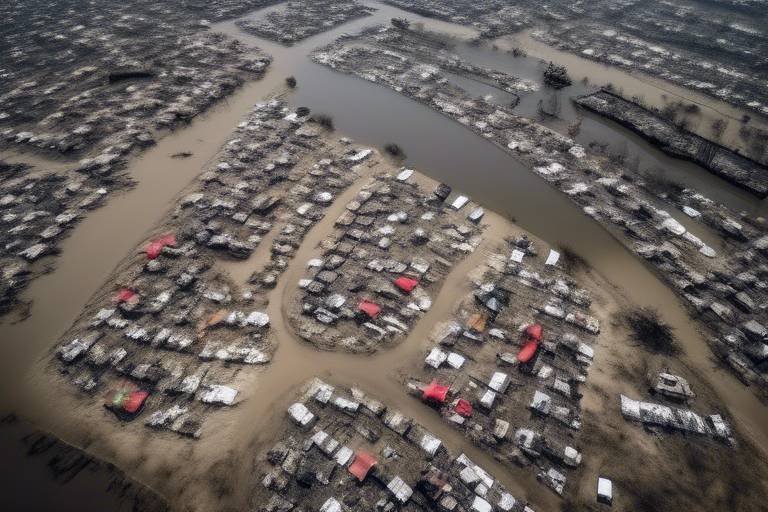
Geospatial Analysis for Resource Allocation
In the chaotic aftermath of a disaster, one of the most significant challenges faced by relief organizations is determining where to allocate resources effectively. This is where geospatial analysis comes into play. By utilizing geographic information systems (GIS) and advanced mapping technologies, responders can visualize the impacted areas and make data-driven decisions that enhance the efficiency of their operations.
Imagine trying to find your way in a dense forest without a map or compass. It's easy to get lost, and critical resources may never reach those who need them the most. Similarly, in disaster scenarios, the ability to see the landscape—both literally and figuratively—can mean the difference between life and death. Geospatial analysis provides responders with a comprehensive view of the affected regions, helping them identify high-priority zones that require immediate attention.
Geospatial tools allow responders to layer various data sets, such as population density, infrastructure damage, and accessibility of roads. This layered approach is crucial for understanding the full scope of a disaster. For instance, if a hurricane has struck a coastal area, responders can use geospatial analysis to:
- Identify communities that are cut off from traditional supply routes.
- Assess the extent of damage to critical infrastructure like hospitals and shelters.
- Determine the locations of vulnerable populations, such as the elderly or those with disabilities.
Moreover, the integration of real-time data into geospatial analysis enhances its effectiveness. As new information becomes available—whether through satellite imagery, drone surveillance, or reports from field teams—responders can update their maps and adjust their strategies accordingly. This dynamic approach ensures that resources are not only allocated based on initial assessments but are continuously optimized as the situation evolves.
To illustrate the importance of geospatial analysis in resource allocation, consider the following table that outlines the key benefits:
| Benefit | Description |
|---|---|
| Improved Decision Making | Allows responders to make informed choices based on accurate data. |
| Efficient Resource Distribution | Ensures that aid reaches those who need it most, minimizing waste. |
| Enhanced Coordination | Facilitates collaboration among various organizations and agencies involved in relief efforts. |
| Real-Time Adaptability | Enables quick adjustments to plans based on changing circumstances. |
In conclusion, geospatial analysis serves as a vital tool in disaster management, transforming how organizations approach resource allocation. By leveraging advanced mapping technologies, responders can navigate the complexities of disaster scenarios with greater precision and effectiveness. As technology continues to evolve, the integration of geospatial analysis will undoubtedly play an increasingly central role in ensuring that humanitarian efforts are both timely and impactful.
- What is geospatial analysis?
Geospatial analysis involves using geographic information systems (GIS) to analyze spatial data and visualize locations, helping in decision-making processes during disaster management. - How does geospatial analysis improve disaster response?
It allows responders to assess damage, identify high-priority areas, and allocate resources efficiently based on real-time data and historical trends. - Can geospatial analysis be used in non-disaster situations?
Yes, it is also used in urban planning, environmental monitoring, and various fields requiring spatial data analysis.
Frequently Asked Questions
-
What technologies are currently being used in disaster relief?
Disaster relief efforts are increasingly utilizing a range of innovative technologies. Some of the most notable include drones for aerial surveillance and supply delivery, artificial intelligence for data analysis and predictive modeling, and mobile communication technologies that keep responders and affected communities connected. These advancements help streamline operations and enhance the effectiveness of humanitarian efforts.
-
How do drones assist in disaster response?
Drones play a crucial role in disaster response by providing real-time aerial views of affected areas, which helps in assessing damage and identifying locations that need immediate attention. They can also deliver essential supplies like food, water, and medical aid to remote or hard-to-reach locations, ultimately saving lives and resources during emergencies.
-
What role does AI play in disaster management?
AI and machine learning are game-changers in disaster management. They analyze vast amounts of data quickly, helping predict potential disasters and optimize response strategies. By utilizing predictive modeling, organizations can simulate various disaster scenarios, allowing them to prepare more effectively and allocate resources where they are needed most.
-
How do mobile apps enhance disaster relief efforts?
Mobile apps are revolutionizing disaster relief by enabling users to report incidents, request assistance, and receive crucial updates in real-time. These applications foster better communication among responders and the affected communities, enhancing engagement and support during crises.
-
What is geospatial analysis and how is it used in disaster management?
Geospatial analysis involves using geographic information systems (GIS) to visualize affected areas. This technology helps responders optimize resource allocation and ensure that aid reaches those in need as efficiently as possible. By analyzing spatial data, organizations can make informed decisions during disaster response efforts.
-
Can satellite communication systems be relied upon during disasters?
Absolutely! Satellite communication systems provide a reliable means of connectivity in disaster-stricken areas, especially when traditional networks are down. This ensures that rescue teams can communicate effectively and that affected individuals can reach out for help.