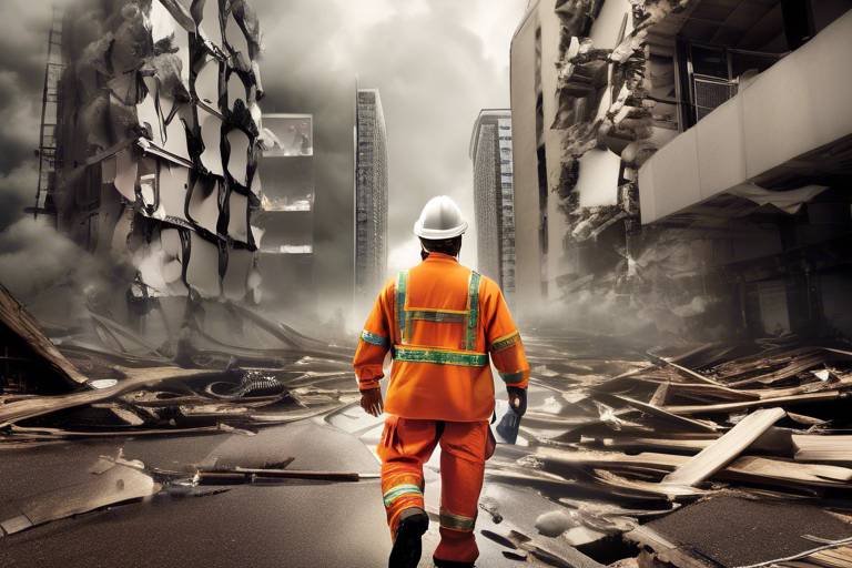
Exploring the Role of Technology in Disaster Response
In today’s fast-paced world, the impact of technology on disaster response is nothing short of revolutionary. Imagine a scenario where a natural disaster strikes, and within moments, responders have access to real-time data, clear communication channels, and efficient resource allocation. This isn’t just a dream; it’s the reality we are building through the integration of advanced technologies into disaster management. The essence of effective disaster response lies in the ability to quickly assess the situation, communicate effectively, and mobilize resources efficiently. With the advent of cutting-edge tools such as drones, satellite imagery, and mobile applications, the landscape of crisis management is evolving rapidly, paving the way for more coordinated and effective responses.
As we dive deeper into the various technologies employed in disaster response, it’s essential to understand that communication is the backbone of any successful operation. Whether it's sharing critical information among responders or disseminating alerts to the public, technology plays a pivotal role in ensuring that everyone is on the same page. Furthermore, geospatial technologies like Geographic Information Systems (GIS) and remote sensing are not just buzzwords; they are fundamental in mapping affected areas and planning interventions that save lives.
For instance, consider the role of satellite imagery in damage assessment. After a disaster, the ability to visualize the extent of destruction can significantly influence the allocation of resources. This is where technology shines, providing responders with the insights needed to make informed decisions. Additionally, the use of drones and sensors for real-time data collection enhances situational awareness, allowing for a more agile and responsive approach to crisis management.
In this article, we will explore the multifaceted role of technology in disaster response, examining how it enhances communication, utilizes geospatial tools, engages communities, and leverages artificial intelligence for better outcomes. By understanding these elements, we can appreciate the profound impact technology has on saving lives and restoring communities after disasters.

The Importance of Communication Technology
When disaster strikes, the chaos can be overwhelming. Imagine a world where every second counts, yet vital information is trapped in silos, unable to reach those who need it most. This is where communication technology steps in as a game changer. It acts as the lifeline connecting responders, victims, and support organizations, ensuring that everyone is on the same page. Think of it as a well-oiled machine, where each cog plays a critical role in the machinery of crisis management.
During emergencies, effective communication is not just important; it is essential. The ability to share real-time information can make the difference between life and death. For instance, when a natural disaster occurs, timely updates about evacuation routes, shelter locations, and resource availability can help save lives. Communication technology enables this flow of information through various channels, including mobile apps, social media, and dedicated emergency response systems.
Moreover, the integration of communication tools allows for a coordinated response among multiple agencies. Imagine a scenario where firefighters, medical teams, and volunteers are all working together seamlessly. This level of coordination is made possible through advanced communication technologies that facilitate instant updates and information sharing. Here are some key components:
- Mobile Communication: Mobile phones and apps provide instant notifications and updates to both responders and the public.
- Social Media: Platforms like Twitter and Facebook can disseminate information rapidly, reaching a broad audience in a matter of seconds.
- Two-way Communication Systems: These systems allow for feedback from the community, ensuring that responders can adapt to evolving situations.
In a world where misinformation can spread just as quickly as accurate information, the role of technology in ensuring reliable communication cannot be overstated. It is crucial to have systems in place that not only relay information but also verify its accuracy. This is where advanced analytics come into play, helping to filter out noise and highlight what truly matters. As technology continues to evolve, we can expect even more sophisticated tools that will enhance our ability to communicate effectively during disasters.
In conclusion, communication technology is not just a tool; it is the backbone of effective disaster response. It empowers communities, enhances situational awareness, and ultimately saves lives. As we look towards the future, investing in these technologies will be paramount in building resilience against disasters. After all, in times of crisis, clear and effective communication can be the beacon of hope that guides us through the storm.

Geospatial Technologies in Disaster Management
When a disaster strikes, the chaos can be overwhelming. However, with the advent of geospatial technologies, we now have powerful tools at our disposal to navigate through the turmoil. Geospatial technologies, including Geographic Information Systems (GIS) and remote sensing, are revolutionizing the way we manage disasters. These technologies provide invaluable insights that help responders assess situations, allocate resources, and plan effective interventions. Imagine having the ability to visualize the disaster's impact from above; that’s exactly what these tools allow us to do.
GIS is particularly critical in disaster management as it enables us to create detailed maps that illustrate the affected areas. These maps can show everything from population density to infrastructure damage, allowing responders to prioritize their efforts effectively. For instance, during a flood, GIS can identify which neighborhoods are most at risk and need immediate attention. The ability to layer various data sets on a single map can make a world of difference in crisis situations.
One of the standout features of geospatial technologies is the use of satellite imagery. After a disaster, satellite images can provide critical data for assessing damage. This information is not just useful; it’s essential for guiding relief efforts and resource allocation in affected regions. For example, after a hurricane, satellite imagery can reveal which areas are inundated with water and which roads are impassable. With this information, emergency responders can make informed decisions about where to send aid and how to navigate the affected areas.
In addition to satellite imagery, real-time data collection through drones and sensors has become a game-changer in disaster response. Drones can fly over disaster zones, capturing high-resolution images and gathering data that can inform situational awareness. This real-time information is crucial; it allows decision-makers to see the situation as it evolves, rather than relying on outdated reports. Imagine being able to monitor a wildfire's spread in real-time—this capability can save lives and property.
Another significant application of geospatial technologies is in mapping evacuation routes. When disaster strikes, clear and updated maps are essential for guiding evacuations. GIS can help create dynamic maps that show safe passage for affected populations, taking into account the latest information on hazards like flooding or fires. By providing accurate and timely evacuation routes, we can ensure that individuals can escape danger quickly and efficiently.
Overall, geospatial technologies play a vital role in disaster management, enabling responders to visualize, assess, and act during crises. The integration of these tools into disaster response plans not only enhances the efficiency of operations but also significantly improves safety for individuals affected by disasters. As we continue to advance in technology, the potential for these tools to save lives and mitigate damage becomes even greater.
- What are geospatial technologies? Geospatial technologies encompass tools like GIS, remote sensing, and satellite imagery that help in mapping and analyzing geographical data.
- How do geospatial technologies assist in disaster management? They provide critical insights into affected areas, enabling better planning, resource allocation, and real-time assessment of situations during disasters.
- Can drones be used in disaster response? Yes, drones are increasingly used to gather real-time data and imagery in disaster zones, aiding in situational awareness and decision-making.
- Why is satellite imagery important after a disaster? Satellite imagery helps assess damage and guides relief efforts by providing a comprehensive view of the affected regions.

Satellite Imagery for Damage Assessment
Satellite imagery has revolutionized the way we assess damage following disasters, providing a bird's-eye view that is both comprehensive and invaluable. When a natural disaster strikes, be it a hurricane, earthquake, or flood, the immediate aftermath can be chaotic and disorienting. In such moments, having accurate and timely information is crucial for effective response and recovery efforts. This is where satellite imagery comes into play, acting as a powerful tool for damage assessment and resource allocation.
Imagine trying to find your way through a dense fog without a map. That's what disaster responders face when they lack clear, real-time information about the affected areas. Satellite imagery cuts through that fog, offering high-resolution images that reveal the extent of the damage. These images enable authorities to quickly identify hard-hit regions, assess infrastructure damage, and prioritize areas that need immediate assistance.
One of the key advantages of satellite imagery is its ability to cover vast areas in a short amount of time. For example, after a major earthquake, ground teams may be hindered by debris or unsafe conditions, making it difficult to gather information on the ground. In contrast, satellites orbiting the Earth can capture images of the affected areas from space, providing critical data without the risks associated with ground-level assessments. This capability is particularly important in remote or inaccessible locations where traditional methods may fail.
Moreover, satellite imagery is not just about capturing images; it's about analyzing them. Advanced software can process these images to detect changes over time, allowing responders to monitor the evolution of a disaster's impact. For instance, by comparing pre- and post-disaster images, analysts can quantify the extent of damage, such as the number of buildings destroyed or the area of farmland affected. This information is crucial for planning effective interventions and allocating resources where they are most needed.
To illustrate the impact of satellite imagery, consider the following table that summarizes its key benefits:
| Benefit | Description |
|---|---|
| Rapid Assessment | Provides immediate data on affected areas, allowing for quick decision-making. |
| Wide Coverage | Covers large geographical areas, including remote locations that are hard to access. |
| Data Analysis | Facilitates detailed analysis of damage over time, improving future response strategies. |
| Resource Allocation | Helps prioritize areas for aid based on the severity of damage observed. |
In addition to immediate assessments, satellite imagery also plays a vital role in long-term recovery efforts. By providing a baseline for what the area looked like before the disaster, it allows planners to visualize the recovery process and track progress over time. This not only helps in rebuilding efforts but also in understanding the broader impacts of disasters on communities and ecosystems.
In conclusion, satellite imagery is an essential component of modern disaster response. Its ability to provide real-time, comprehensive data allows for informed decision-making and efficient resource allocation, ultimately saving lives and aiding recovery efforts. As technology continues to advance, we can expect even greater innovations in how we utilize satellite imagery to respond to disasters, making our world a safer place.
- How does satellite imagery work in disaster assessment? Satellite imagery captures high-resolution images of the Earth's surface from space, allowing for detailed analysis of damage and changes over time.
- What types of disasters can satellite imagery help assess? Satellite imagery is useful for assessing a wide range of disasters, including hurricanes, floods, earthquakes, and wildfires.
- Is satellite imagery available in real-time? Yes, many satellite systems can provide near real-time imagery, which is crucial for timely disaster response.
- How do responders use satellite imagery? Responders analyze satellite images to identify affected areas, assess damage, and prioritize resource allocation for recovery efforts.

Real-time Data Collection
In the chaotic aftermath of a disaster, having access to real-time data can be a game changer. Imagine a situation where every second counts—emergency responders need to know exactly what's happening on the ground to make informed decisions. This is where advanced technologies like drones and sensors come into play. These tools are not just high-tech gadgets; they are lifelines that enhance situational awareness and provide critical information to those who need it most.
Drones, equipped with high-resolution cameras and sensors, can quickly survey affected areas, capturing images and data that would take human teams much longer to collect. This rapid assessment allows responders to identify the most severely impacted regions, prioritize their efforts, and allocate resources more effectively. For instance, a drone can fly over a flooded area, sending back real-time footage that shows where the water is rising and which buildings are at risk. This capability is like having a bird's-eye view of a disaster, enabling teams to plan their next steps with precision.
Moreover, ground-based sensors can monitor environmental conditions such as air quality, temperature, and radiation levels. These sensors feed data back to command centers, creating a comprehensive picture of the disaster's impact. The integration of these technologies means that responders aren't operating in the dark; they have access to vital information that can save lives. For example, if a sensor detects a hazardous gas leak, responders can take immediate action to evacuate nearby residents and mitigate risks.
To illustrate the effectiveness of real-time data collection, consider the following table that outlines the key technologies used in disaster response:
| Technology | Function | Benefits |
|---|---|---|
| Drones | Aerial surveillance and mapping | Quick assessment of affected areas, real-time imagery |
| Ground Sensors | Environmental monitoring | Immediate data on hazardous conditions |
| Mobile Apps | Information dissemination | Alerts and updates to the public |
By harnessing the power of real-time data collection, disaster response teams can operate more efficiently and effectively. The ability to act on accurate, timely information is akin to having a GPS in an unfamiliar city—it guides the way and helps avoid obstacles. In a world where every moment matters, these technologies are not just tools; they are essential components of a robust disaster response strategy.
- What types of data can drones collect during a disaster? Drones can capture high-resolution images, thermal data, and even environmental conditions like air quality.
- How do ground sensors contribute to disaster response? Ground sensors provide real-time monitoring of environmental hazards, enabling quick action to protect affected populations.
- Are mobile applications useful in disaster preparedness? Yes, mobile apps can send alerts, provide safety tips, and connect communities, making them vital for preparedness and response.

Mapping Evacuation Routes
When disaster strikes, every second counts, and having clear evacuation routes can mean the difference between safety and chaos. Mapping evacuation routes using advanced geospatial technologies is not just a luxury; it's a necessity. Imagine a scenario where a hurricane is approaching, and people are scrambling to find the safest path out of harm's way. This is where technology steps in, providing real-time data that can guide individuals to safety.
Geospatial tools, such as Geographic Information Systems (GIS), allow emergency responders to visualize and analyze data on the fly. These systems can integrate various layers of information, such as population density, road conditions, and potential hazards, to create detailed maps that highlight the safest and most efficient evacuation routes. For instance, if a flood is imminent, GIS can help identify which roads are likely to be submerged, allowing planners to redirect traffic accordingly.
In addition to GIS, mobile applications equipped with mapping capabilities can keep the public informed. Residents can access updated maps on their smartphones, providing them with the latest information on road closures and safe passages. This is particularly important in urban areas where traffic congestion can quickly become a nightmare. By using real-time data, these apps can suggest alternative routes, helping to alleviate bottlenecks and ensuring that evacuation processes run smoothly.
Furthermore, the importance of community involvement cannot be overstated. Local authorities can engage residents in the mapping process, gathering insights about their neighborhoods. This grassroots approach not only enhances the accuracy of the maps but also fosters a sense of community responsibility. When people are involved in planning their safety, they are more likely to follow through with evacuation plans. For example, community meetings can be held to discuss potential evacuation routes, allowing residents to voice their concerns and suggestions.
To illustrate the effectiveness of mapped evacuation routes, consider the following table that outlines the benefits of utilizing geospatial technologies in disaster scenarios:
| Benefit | Description |
|---|---|
| Real-time Updates | Maps can be updated instantly to reflect changing conditions, ensuring that evacuees have the most accurate information. |
| Increased Efficiency | Optimized routes reduce travel time and help avoid congested areas, allowing for quicker evacuations. |
| Enhanced Safety | Identifying hazards and blocked roads in advance helps protect individuals from unexpected dangers. |
In conclusion, mapping evacuation routes is a critical component of disaster response that leverages technology to save lives. By integrating real-time data, engaging communities, and utilizing advanced mapping tools, we can ensure that people have the information they need to evacuate safely and efficiently when disaster strikes.
Q: How are evacuation routes determined?
A: Evacuation routes are determined by analyzing various factors, including population density, transportation infrastructure, and potential hazards. Emergency planners use geospatial technologies to create the most effective routes.
Q: Can evacuation routes change during a disaster?
A: Yes, evacuation routes can change based on real-time conditions. Authorities continuously monitor the situation and update maps to reflect road closures or hazards, ensuring public safety.
Q: How can I stay informed about evacuation routes in my area?
A: You can stay informed by downloading local emergency management apps, following official social media accounts, or signing up for community alerts that provide real-time information during emergencies.

Social Media as a Communication Tool
In today's fast-paced world, social media has emerged as a game-changer in disaster response communication. Imagine a scenario where a natural disaster strikes—people are panicking, roads are blocked, and traditional communication channels are down. In such chaotic moments, social media platforms like Twitter, Facebook, and Instagram become lifelines, allowing for the rapid dissemination of crucial information. These platforms enable responders to share updates, safety instructions, and resource availability almost instantaneously, reaching a broad audience in mere seconds.
One of the most remarkable features of social media during disasters is its ability to facilitate community engagement. Individuals affected by a crisis can share their experiences, report on conditions in their areas, and even offer help to their neighbors. This grassroots communication creates a sense of solidarity and resilience among communities. For instance, during Hurricane Harvey, social media was flooded with posts from residents offering shelter, food, and transportation, effectively turning the platform into a vital resource hub.
Moreover, the power of hashtags cannot be underestimated. A simple hashtag can unify conversations around a particular disaster, making it easier for responders and citizens to find relevant information quickly. For example, during the 2018 Indonesia earthquake, hashtags like #PrayForPalu trended globally, mobilizing international aid and support. It’s astonishing how a few characters can ignite a worldwide response!
However, the use of social media in disaster response is not without its challenges. Misinformation can spread just as quickly as accurate information, leading to confusion and panic. This highlights the need for verified accounts and official communication from disaster management agencies. To combat misinformation, it’s crucial for organizations to actively engage on these platforms, providing real-time updates and corrections when necessary. By doing so, they can establish trust and ensure that the information circulating within communities is accurate.
In summary, social media has revolutionized the way we communicate during disasters. Its ability to connect people, share information quickly, and foster community spirit is unparalleled. As technology continues to evolve, the integration of social media into disaster response strategies will only become more critical. It’s a testament to how we can harness the power of connection to navigate through the toughest of times.
- How can social media improve disaster response?
Social media improves disaster response by providing real-time updates, facilitating community engagement, and enabling quick information dissemination. - What are the risks of using social media during disasters?
The main risks include the spread of misinformation, which can lead to confusion and panic among affected populations. - How can organizations combat misinformation on social media?
Organizations can combat misinformation by actively engaging with the community, providing verified updates, and correcting false information promptly. - Can social media help in mobilizing resources during a disaster?
Yes, social media can mobilize resources by connecting those in need with individuals and organizations willing to help, creating a network of support.

Mobile Applications for Disaster Preparedness
In today's fast-paced world, having the right tools at your fingertips can make all the difference when disaster strikes. Mobile applications have emerged as essential allies in disaster preparedness and response, transforming how individuals and communities prepare for emergencies. Imagine having a personal assistant that not only alerts you of impending threats but also guides you through safety protocols and connects you with vital resources. This is precisely what these innovative apps offer!
Mobile applications serve multiple purposes, from providing real-time alerts to sharing critical safety information. For instance, many apps are designed to send out emergency notifications that inform users of natural disasters such as hurricanes, floods, or earthquakes. These alerts can be life-saving, allowing individuals to take quick action. Think of it as having a safety net that catches you just before you fall into chaos. Timely notifications can mean the difference between safety and disaster.
Furthermore, these applications often come equipped with features that educate users about disaster preparedness. They provide checklists for emergency kits, safety tips for various scenarios, and even interactive maps showing evacuation routes. For example, a user might find themselves in a situation where they need to evacuate quickly. With an app that displays real-time traffic updates and safe routes, they can navigate the chaos more effectively. This is where technology shines—turning what could be a panic-filled experience into a more manageable situation.
Moreover, community engagement is another significant aspect of mobile applications in disaster preparedness. Many apps foster collaboration among residents, allowing them to share resources, offer support, and communicate effectively during crises. For example, a community-focused app might enable users to report local hazards, share information about shelters, or coordinate volunteer efforts. This sense of community can be incredibly reassuring during trying times, almost like having a network of friends ready to lend a hand.
To illustrate the impact of mobile applications on disaster preparedness, consider the following table that highlights some popular apps and their key features:
| App Name | Key Features | Platform |
|---|---|---|
| FEMA | Emergency alerts, preparedness tips, disaster resources | iOS, Android |
| Red Cross Emergency | First aid information, emergency alerts, safety kits | iOS, Android |
| Disaster Alert | Global disaster alerts, maps, and news updates | iOS, Android |
| MyRadar | Real-time weather updates, radar images, severe weather alerts | iOS, Android |
As we can see, these applications are not just about sending notifications; they encompass a wide range of features designed to enhance preparedness and response. With the ability to access crucial information and connect with others, mobile apps empower individuals to take charge of their safety.
In conclusion, mobile applications are revolutionizing disaster preparedness by providing timely information, fostering community engagement, and equipping individuals with the knowledge they need to stay safe. They serve as a digital lifeline, ensuring that when disaster strikes, you are not alone and have the tools necessary to navigate through the storm.
- What types of disasters can mobile apps help prepare for? Mobile apps can assist with various disasters, including natural disasters like hurricanes, earthquakes, floods, and man-made emergencies.
- Are these apps available for free? Many disaster preparedness apps are available for free, though some may offer premium features for a fee.
- How can I ensure I receive alerts on my mobile app? Make sure to enable notifications for the app and set your location preferences to receive relevant alerts.
- Can I use these apps offline? Some apps provide offline access to essential information, but it's best to check the app's specifications.

Emergency Alert Systems
In a world where disasters can strike at any moment, the importance of (EAS) cannot be overstated. These systems are designed to provide timely notifications to communities about impending threats, such as natural disasters, severe weather, or other emergencies. Imagine a scenario where a tornado is approaching your town. With an effective EAS in place, you would receive an alert on your mobile device, giving you crucial information on how to stay safe. This instantaneous communication can be the difference between life and death.
Emergency Alert Systems utilize a variety of technologies to broadcast messages quickly and efficiently. They can send alerts via text messages, emails, social media, and even traditional radio and television broadcasts. This multi-channel approach ensures that information reaches as many people as possible, regardless of their preferred communication method. For instance, during Hurricane Katrina, EAS played a vital role in disseminating evacuation orders and safety information, which saved countless lives.
One of the most significant advantages of modern EAS is their integration with mobile applications. Many local and state governments have developed apps that not only provide emergency alerts but also offer real-time updates on the situation. These apps often include features such as:
- Live weather updates
- Safety tips and resources
- Interactive maps for evacuation routes
- Community forums for sharing information
Moreover, the effectiveness of these systems relies heavily on public participation. Communities are encouraged to sign up for alerts, ensuring that they receive the information they need when it matters most. It’s like having a personal safety net that keeps you informed and prepared. However, it’s essential for individuals to keep their contact information updated to avoid missing critical notifications.
To illustrate the impact of Emergency Alert Systems, consider the following table that outlines the key features and benefits:
| Feature | Benefit |
|---|---|
| Multi-channel alerts | Reaches a wider audience quickly |
| Real-time updates | Provides the latest information to help make informed decisions |
| Mobile app integration | Convenient access to alerts and resources at your fingertips |
| Community engagement | Fosters collaboration and support among residents |
In conclusion, Emergency Alert Systems are a vital component of disaster preparedness and response. They empower individuals and communities to take action when faced with emergencies. By staying informed and engaged, we can collectively enhance our safety and resilience in the face of disasters. Remember, it’s not just about receiving alerts; it’s about understanding their significance and acting promptly to protect ourselves and our loved ones.
1. What types of alerts can I receive from Emergency Alert Systems?
You can receive alerts for severe weather, natural disasters, public safety threats, and other emergencies.
2. How do I sign up for Emergency Alerts?
You can typically sign up through your local government’s website or by downloading their emergency management app.
3. Are Emergency Alert Systems free to use?
Yes, most Emergency Alert Systems are free for the public to use, although standard data rates may apply for text messages.
4. What should I do if I receive an emergency alert?
Follow the instructions provided in the alert, such as evacuating to a safe location or seeking shelter.
5. How can I ensure I receive alerts?
Keep your contact information updated with your local emergency management agency and consider downloading relevant mobile apps.

Community Engagement through Apps
In today's fast-paced world, community engagement has taken on a new dimension, especially when it comes to disaster response. Mobile applications have emerged as a vital tool that not only disseminates information but also fosters collaboration among residents. Imagine a neighborhood banding together like a well-oiled machine, each member equipped with real-time updates and resources at their fingertips. This is the power of community engagement through apps!
These applications serve as a hub for sharing critical information, including safety tips and local resources, which can make all the difference during a disaster. For instance, when a natural disaster strikes, community members can use these apps to report incidents, share updates, and even offer assistance to those in need. It's like having a digital neighborhood watch that operates 24/7, ready to respond at a moment's notice.
Moreover, many of these apps feature social networking capabilities, allowing users to connect with each other and build a support network. This is particularly important during emergencies when individuals may feel isolated or overwhelmed. By fostering a sense of community through these platforms, residents can share experiences, offer emotional support, and coordinate efforts to aid those affected by a disaster.
Some key features of community engagement apps include:
- Resource Sharing: Users can post available resources such as food, shelter, or medical supplies, helping to ensure that those in need receive assistance quickly.
- Real-time Alerts: Notifications about emergencies, safety tips, and local resources can be sent directly to users, keeping everyone informed.
- Volunteer Coordination: Apps can facilitate the organization of volunteer efforts, making it easier for community members to come together and help each other.
Additionally, these apps often incorporate features that allow for feedback and suggestions from users, creating a two-way communication channel. This is crucial because it not only empowers community members but also helps local authorities and organizations understand the needs and concerns of the population they serve.
In essence, community engagement through mobile applications is not just about technology; it’s about human connection. It transforms the way we interact during crises, turning passive observers into active participants in their own safety and recovery. When communities come together, leveraging technology, the impact is profound. The collective strength of a well-informed and engaged community can significantly enhance disaster response efforts, leading to quicker recovery and a more resilient society.
- How do community engagement apps work during a disaster?
These apps allow users to share information, report incidents, and connect with local resources, facilitating communication and collaboration among community members. - What features should I look for in a community engagement app?
Look for features like real-time alerts, resource sharing, and volunteer coordination to ensure effective communication during emergencies. - Can these apps help in long-term disaster preparedness?
Absolutely! By fostering community connections and sharing resources, these apps can enhance preparedness and resilience in the face of future disasters.

Artificial Intelligence in Crisis Management
Artificial Intelligence (AI) is not just a buzzword; it’s a game changer in the realm of disaster response. Imagine a world where machines can analyze vast amounts of data in seconds, predicting where help is needed most before the situation escalates. This is the reality that AI brings to crisis management. By processing information from various sources, AI can identify patterns and predict trends, allowing emergency responders to allocate resources more effectively. For instance, during natural disasters like hurricanes or wildfires, AI algorithms can assess the severity of the situation and suggest optimal routes for evacuation or resource distribution.
One of the most significant advantages of AI in disaster management is its capability for predictive analytics. This involves using historical data and real-time information to forecast future events. For example, AI can analyze weather patterns, ground conditions, and even social media trends to predict how a disaster might unfold. This kind of foresight can be crucial in making timely decisions that save lives. Think of it as having a crystal ball that doesn’t just show the future but provides actionable insights to prepare for it.
Moreover, AI-driven solutions can automate response systems, significantly reducing the time it takes to mobilize resources. These automated systems can assess situations quickly, determine the level of response required, and even deploy resources without human intervention. For instance, in the aftermath of an earthquake, drones equipped with AI can survey the affected area, identify blocked routes, and relay this information back to command centers, enabling a rapid and coordinated response.
To illustrate the impact of AI in crisis management, consider the following table that outlines key AI applications and their benefits:
| AI Application | Benefits |
|---|---|
| Predictive Analytics | Forecasts disaster impacts and resource needs. |
| Automated Response Systems | Reduces response time and enhances efficiency. |
| Data Analysis | Identifies patterns to improve future disaster preparedness. |
| Drones and Robotics | Conducts search and rescue missions in hazardous areas. |
As we delve deeper into the capabilities of AI, it’s essential to recognize the importance of collaboration between technology and human expertise. AI can provide the insights and data necessary for effective decision-making, but human judgment is irreplaceable when it comes to ethical considerations and community engagement. The integration of AI into disaster response strategies should be seen as a partnership, where technology supports human efforts rather than replacing them.
In conclusion, the role of AI in crisis management is transformative. By enhancing predictive capabilities and streamlining response processes, AI not only improves the efficiency of disaster management efforts but also ultimately saves lives. As technology continues to advance, the potential for AI to revolutionize how we respond to crises is boundless, paving the way for a future where we are better prepared for the unexpected.
- What is the role of AI in disaster management? AI enhances predictive analytics, automates response systems, and aids in data analysis to improve disaster response efficiency.
- How does predictive analytics work? It uses historical and real-time data to forecast future disaster impacts and resource allocation needs.
- Can AI replace human responders? No, AI supports human efforts but cannot replace the essential human judgment required in crisis situations.
- What technologies are used alongside AI in disaster response? Drones, remote sensing, and GIS technologies are often integrated with AI for comprehensive disaster management.

Predictive Analytics for Resource Allocation
When it comes to disaster response, the ability to allocate resources efficiently can mean the difference between life and death. Predictive analytics, a branch of data analysis that uses statistical algorithms and machine learning techniques, plays a pivotal role in enhancing this process. By analyzing historical data, weather patterns, and social media trends, predictive analytics helps responders anticipate needs and deploy resources where they are most likely to be required.
Imagine a scenario where a hurricane is approaching a coastal city. Traditional methods of resource allocation may rely on past experiences and gut feelings, but predictive analytics can provide a data-driven approach. For instance, algorithms can analyze variables such as population density, historical damage reports, and real-time weather updates to predict which areas will be hit hardest. This allows disaster management teams to pre-position supplies, such as food, water, and medical kits, in areas that are projected to be most affected.
Moreover, predictive analytics can assist in optimizing logistics. By understanding traffic patterns and potential road blockages, responders can plan the most efficient routes for delivering aid. This is where the integration of real-time data becomes crucial. For example, a table illustrating the predicted demand for resources in various regions can guide decision-makers in prioritizing their efforts:
| Region | Predicted Demand (Units) | Pre-Positioning Strategy |
|---|---|---|
| North Zone | 500 | Deploy 300 units at the community center |
| East Zone | 800 | Set up a mobile unit for rapid response |
| South Zone | 300 | Stockpile at local fire station |
| West Zone | 600 | Coordinate with local NGOs for distribution |
Additionally, predictive analytics can help in assessing the effectiveness of resource allocation post-disaster. By analyzing the outcomes of previous interventions, responders can refine their strategies for future events, learning from what worked and what didn’t. This continuous feedback loop enhances the overall efficiency of disaster response efforts.
As we delve deeper into the capabilities of predictive analytics, it’s clear that this technology not only aids in immediate resource allocation but also contributes to long-term planning and resilience building. By harnessing the power of data, organizations can ensure that they are not just reacting to disasters but are proactively preparing for them. In a world where climate change and natural disasters are becoming increasingly prevalent, the integration of predictive analytics into disaster management is not just beneficial; it’s essential.
- What is predictive analytics? Predictive analytics is a branch of data analysis that utilizes statistical algorithms and machine learning to forecast future events based on historical data.
- How does predictive analytics improve disaster response? It enhances disaster response by enabling better resource allocation, optimizing logistics, and informing decision-making based on data-driven insights.
- Can predictive analytics be used in real-time during a disaster? Yes, when integrated with real-time data sources, predictive analytics can provide immediate insights that guide responders in crisis situations.
- What types of data are used in predictive analytics for disaster management? Data sources can include historical disaster data, weather patterns, social media activity, and real-time sensor information.

Automated Response Systems
In the chaotic aftermath of a disaster, every second counts. This is where Automated Response Systems (ARS) come into play, revolutionizing the way we manage crisis situations. Imagine a system that can quickly assess the situation, allocate resources, and deploy aid without the need for extensive human intervention. Sounds like something out of a sci-fi movie, right? But this is the reality we are beginning to embrace, and it’s making a significant difference in disaster management.
At its core, an Automated Response System leverages advanced technologies such as artificial intelligence, machine learning, and data analytics to streamline processes that were once painstakingly manual and slow. For instance, during a natural disaster, ARS can analyze real-time data from various sources—like weather reports, social media updates, and on-ground sensors—to determine the most affected areas. This capability not only enhances situational awareness but also allows for rapid decision-making that can save lives.
One of the standout features of ARS is its ability to automatically deploy resources. Consider a scenario where a hurricane has just made landfall. An ARS can instantly notify emergency services, direct them to the hardest-hit locations, and even suggest the most effective routes based on current traffic conditions. This level of automation is crucial because it helps to eliminate human error, ensuring that the right resources reach the right places at the right times.
Furthermore, ARS can provide ongoing updates to responders and the public alike. For example, it can send alerts about changing conditions, such as rising floodwaters or aftershocks, allowing everyone to stay informed and safe. This is particularly important in a world where misinformation can spread like wildfire, potentially leading to panic and confusion.
To illustrate the impact of Automated Response Systems, consider the following table that compares traditional response methods with ARS:
| Aspect | Traditional Response | Automated Response System |
|---|---|---|
| Response Time | Slow, often hours or days | Instantaneous, real-time |
| Resource Allocation | Manual, prone to errors | Data-driven, efficient |
| Communication | Fragmented, delayed | Unified, immediate |
| Public Engagement | Reactive | Proactive, continuous |
As we delve deeper into the capabilities of ARS, we can’t overlook the potential for integration with social media platforms and mobile applications. By connecting these systems, responders can receive alerts from citizens in real-time, enhancing community engagement and fostering collaboration. Imagine a neighborhood using a mobile app to report downed power lines or blocked roads, and the ARS automatically prioritizing these issues based on the data received. This synergy not only empowers communities but also creates a more resilient disaster response framework.
In summary, Automated Response Systems are not just a luxury; they are becoming a necessity in our increasingly unpredictable world. By harnessing the power of technology, we can transform disaster response from a reactive approach into a proactive, efficient, and life-saving operation. As we continue to innovate and integrate these systems, the future of disaster management looks promising, paving the way for safer communities and quicker recovery times.
- What is an Automated Response System? An ARS is a technology-driven system that automates the processes of assessing, allocating, and deploying resources during a disaster.
- How does ARS improve disaster response? ARS improves response times, enhances communication, and ensures efficient resource allocation, ultimately saving lives.
- Can ARS integrate with existing emergency systems? Yes, ARS can be integrated with various emergency management systems, social media platforms, and mobile applications for enhanced efficiency.
- What technologies are used in ARS? ARS utilizes artificial intelligence, machine learning, data analytics, and real-time data from various sources.
Frequently Asked Questions
- How does technology improve disaster response?
Technology enhances disaster response by facilitating real-time communication, enabling efficient resource allocation, and providing critical data for damage assessment. Tools like GIS, drones, and mobile apps ensure that responders can act swiftly and effectively during emergencies.
- What role does communication technology play in disasters?
Communication technology is vital during disasters as it allows for the quick dissemination of information among responders, victims, and support organizations. This ensures coordinated efforts and helps communities stay informed about safety measures and resource availability.
- How are geospatial technologies utilized in disaster management?
Geospatial technologies, such as GIS and remote sensing, are used to map affected areas, assess damage, and plan interventions. They provide crucial insights that help responders understand the scale of the disaster and make informed decisions regarding resource allocation.
- What is the significance of satellite imagery in disaster response?
Satellite imagery is significant in disaster response as it offers a bird's-eye view of the affected regions, enabling accurate damage assessment. This information is essential for guiding relief efforts and ensuring that resources are directed where they are most needed.
- How do mobile applications aid in disaster preparedness?
Mobile applications play a crucial role in disaster preparedness by providing alerts, safety tips, and resources to individuals and communities. They help users stay informed about potential threats and offer guidance on how to respond effectively during emergencies.
- What are emergency alert systems, and why are they important?
Emergency alert systems integrated into mobile apps send timely notifications to users about imminent threats. These alerts are vital for keeping communities informed and safe, allowing individuals to take necessary precautions to protect themselves and their families.
- How does artificial intelligence enhance disaster response?
Artificial Intelligence enhances disaster response by analyzing vast amounts of data to predict trends and inform decision-making. AI-driven tools help in optimizing resource allocation and streamlining processes, which ultimately leads to more effective crisis management.
- What is predictive analytics, and how does it help in disaster scenarios?
Predictive analytics uses historical data and algorithms to forecast future events, allowing for efficient resource allocation during disasters. By understanding potential needs and risks, responders can better prepare and allocate resources where they are most likely to be needed.
- How do automated response systems work in crisis management?
Automated response systems use AI to quickly assess situations during crises, enabling faster decision-making and resource deployment. These systems can analyze data in real-time, ensuring that the right resources are dispatched to the right locations without delay.